
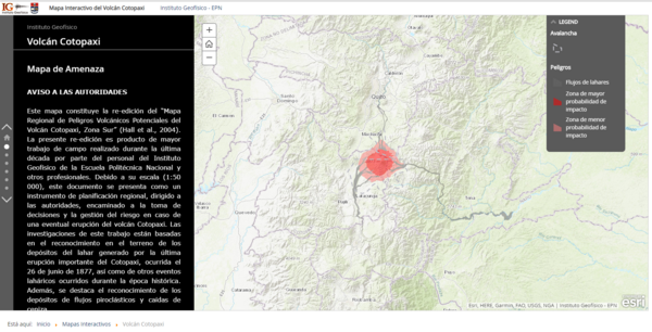
Volcán Cotopaxi Mapa de Amenaza
Cotopaxi Volcano Hazard Map
Cotopaxi, Ecuador, 2019
Instituto Geofísico de la Escuela Politecnica Nacional (IG-EPN). (2019). Volcán Cotopaxi Mapa de Amenaza. Instituto Geofísico de la Escuela Politecnica Nacional, Mapa Interactivo del Volcán Cotopaxi. https://www.igepn.edu.ec/cotopaxi
This map was produced by an official agency, but may not be the most recent, most complete, or main operational map.
For the current operational hazard map, please consult the proper institutional authorities.
Click on thumbnail for full-size map. We do not have copyright permission to display the full-size image. If you are the copyright holder and wish to provide copyright, please contact us at admin@volcanichazardmaps.org.
Simplified, modified, or derived from:
- Mapa Regional de Amenazas Volcánicas Potenciales del Volcán Cotopaxi, Zona Norte
- Mapa Regional de Amenazas Volcánicas Potenciales del Volcán Cotopaxi, Zona Sur
- Mapa Preliminar de Amenazas Potenciales del Volcán Cotopaxi - Zona Oriental