
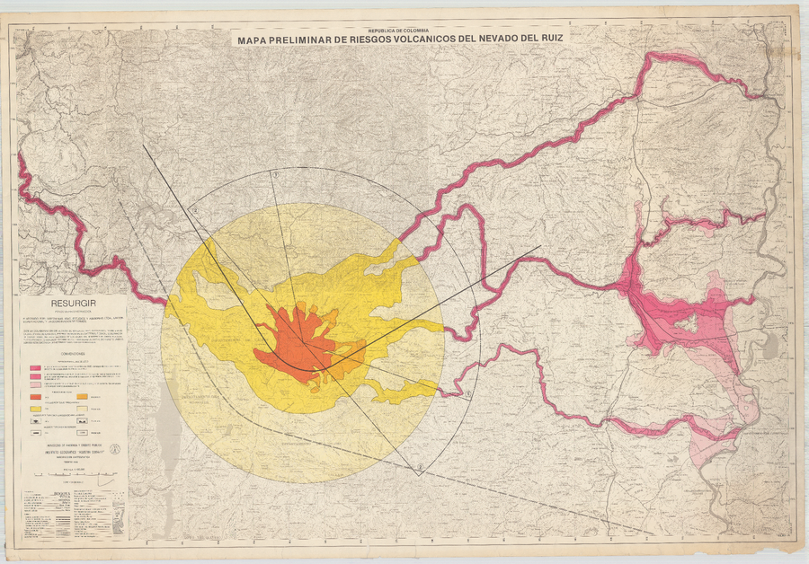
Mapa Preliminar de Riesgos Volcanicos del Nevado del Ruiz (Febrero 1986)
Preliminary Map of Volcanic Risks of the Nevado del Ruiz
Nevado del Ruiz, Colombia, 1986
Instituto Colombiano de Geología y Minería (INGEOMINAS), Instituto Geográfico Agustín Codazzi (IGAC), Estudios y Asesorias LTDA., Universidad Nacional, y la Coordinacion de Fonade. (1986). Mapa Preliminar de Riesgos Volcanicos del Nevado del Ruiz. Instituto Geográfico Agustín Codazzi (IGAC), Febrero 1986, escala 1:100,000
This map was produced by an official agency, but is NOT the most recent, most complete, or main operational map.
For the current operational hazard map, please consult the proper institutional authorities.
Click on image for full-size map. If link seems broken, try the archived version.