
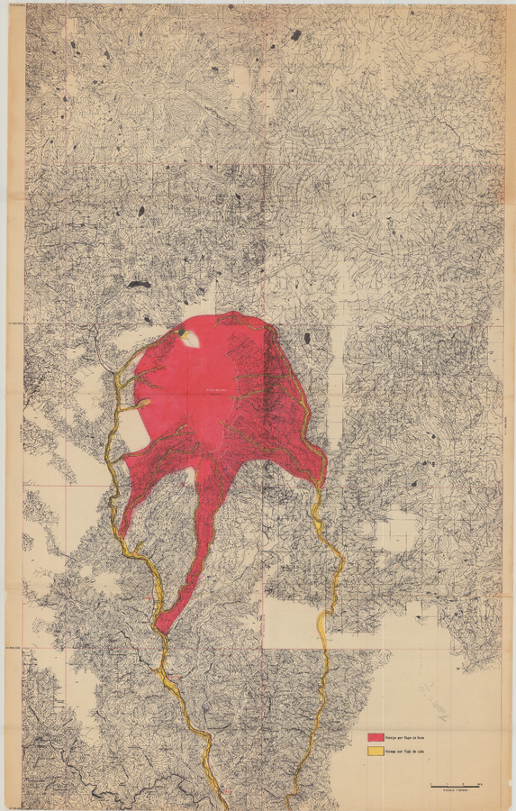
Mapa Preliminar de Riesgos Volcánicos Potenciales del Nevado del Huila, mapa escala 1:50,000
Preliminary Map of Potential Volcanic Risks of the Nevado del Huila, map scale 1: 50,000
Nevado del Huila, Colombia, 1986
Plate 2 in: Cepeda, H., Méndez, R., Murcio, A., & Vergara, H. (1986). Mapa Preliminar de Riesgos Volcanicos Potenciales del Nevado del Huila. Instituto Colombiano de Geología y Minería (INGEOMINAS). Medellín.
This map was produced by an official agency, but is NOT the most recent, most complete, or main operational map.
For the current operational hazard map, please consult the proper institutional authorities.
Click on image for full-size map. If link seems broken, try the archived version.
Cepeda, H., Méndez, R., Murcio, A., & Vergara, H. (1986). Mapa Preliminar de Riesgos Volcanicos Potenciales del Nevado del Huila. INGEOMINAS, Instituto Colombiano de Geología y Minería. Medellín. Map Set
http://recordcenter.sgc.gov.co/B1/11002002501981/documento/pdf/0101019811101000.pdf
Other Maps In Set: