← Back to Search Results

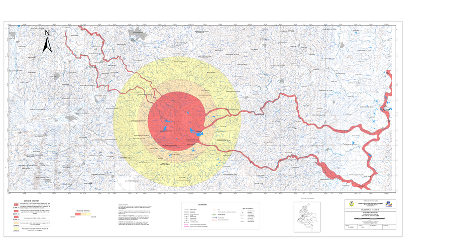
Mapa Preliminar de Amenaza Volcanica Nevado de Santa Isabel

Preliminary Volcanic Hazards Map of Nevado Santa Isabel

Santa Isabel, Colombia, 1992

Digitized version of Plate 1 in: Instituto de Investigaciones en Geociencias, Mineria y Quimica (INGEOMINAS). (1993). Mapa Preliminar de Amenaza Volcanica Potencial Complejo de Domos Santa Isabel, Cordillera Central de Colombia. Ibague.


This map was produced by an official agency, but is NOT the most recent, most complete, or main operational map. For the current operational hazard map, please consult the proper institutional authorities.


Click on image for full-size map. If link seems broken, try the archived version.

Map Set

Instituto de Investigaciones en Geociencias, Mineria y Quimica (INGEOMINAS). (1993). Mapa Preliminar de Amenaza Volcanica Potencial Complejo de Domos Santa Isabel, Cordillera Central de Colombia. Ibague.
http://recordcenter.sgc.gov.co/B1/11002010002162/mapa/pdf/0101021621300002.pdf

Other Maps In Set:

Map Data

Map ID1289
Hazard Process(es)Ballistics; Lahars; Lava dome-related hazards; Lava flows; PDCs; Tephra fall
Hazard Zone PresentationHazard level-focused: All or most hazards are combined by hazard level on a main map panel
Temporal ScaleBackground, or long-term, map
Spatial ScaleVolcano and surrounding area
Publication FormatPoster-style map insert in hazard assessment
Zonation Method(s)Derived/simplified from another map
Zonation Model(s)Energy cone or line (Heim 1932; Sheridan 1979; Sheridan & Malin 1983); HIMAT-FAO (HIMAT-FAO 1987)
Scenario(s) ConsideredSeason or weather; Size, VEI, or intensity; Style or type
Hazard Zone Label(s)Hazard process name
Probability Definition(s)Qualitative relative probability (e.g. high-medium-low)
PurposeMultiple: intended for multiple purposes including general hazard awareness, planning, and crisis management
AudienceMultiple audiences (usually the public, civil authorities, and land-use planners)
Language(s)Spanish
Basemap(s)Hillshade
Basemap overlay(s)Contour lines; Street map
DiemsionalityPlanimetric (2D or map) view
Color SchemeRed to Yellow
Go to Global Volcanism Program page for Santa Isabel →