
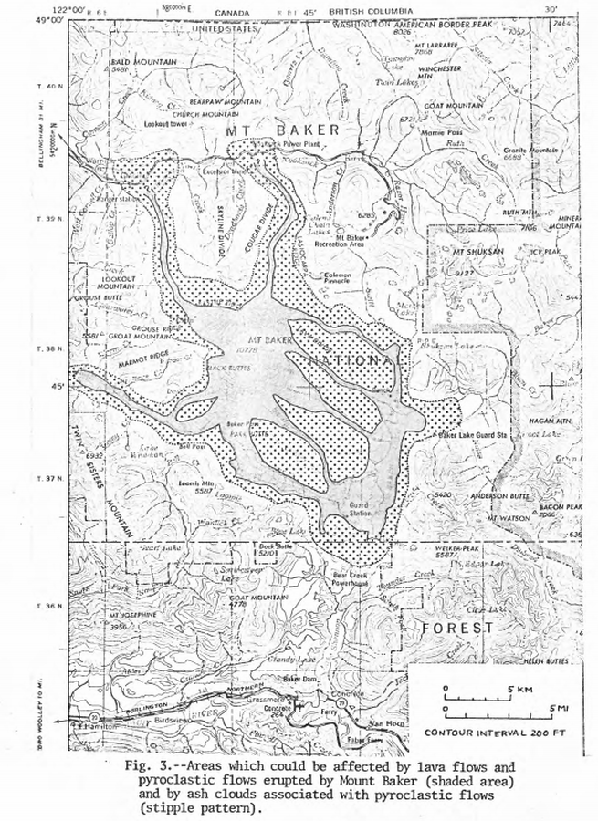
Areas which could be affected by lava flows and pyroclastic flows erupted from Mount Baker and by ash clouds associated with pyroclastic flows
Baker, United States, 1975
Figure 3 in: Hyde, J.H. & Crandell, D.R. (1975). Origin and age of postglacial deposits and assessment of potential hazards from future eruptions of Mount Baker, Washington. U.S. Geological Survey, Open-File Report 75-286, 22 p. https://doi.org/10.3133/ofr75286
This map was produced by an official agency, but is NOT the most recent, most complete, or main operational map.
For the current operational hazard map, please consult the proper institutional authorities.
Click on image for full-size map. If link seems broken, try the archived version.
Hyde, J.H., Crandell, D.R. (1975). Origin and age of postglacial deposits and assessment of potential hazards from future eruptions of Mount Baker, Washington. U.S. Geological Survey, Open-File Report 75-286, 22 p. https://doi.org/10.3133/ofr75286Map Set
https://doi.org/10.3133/ofr75286
Other Maps In Set: