
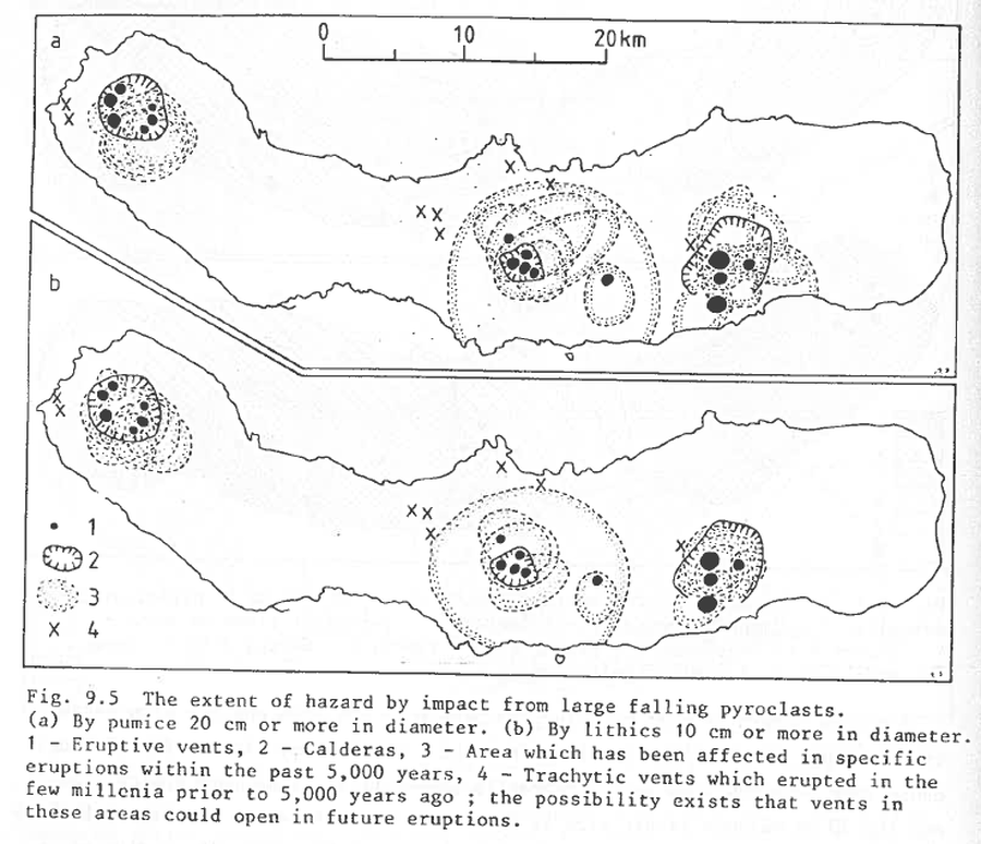
The extent of hazard by impact from large falling pyroclasts
São Miguel (Agua de Pau, Furnas, & Sete Cidades), Sao Miguel, Azores [Portugal], 1983
Figure 9.5 in: Booth, B., Croasdale, R., & Walker, G.L. (1983). Volcanic hazard on Sao Miguel, Azores. In: Tazieff, H. & Sabroux, J.C. (eds.). Forecasting Volcanic Events. Elsevier, Amsterdam. p. 99-109.
This hazard map is the result of scientific research and was published in academic literature.
It is presented here to serve as an example of the map type or the map-making methodology. It is NOT the official, operational map. For the current operational hazard map, please consult the proper institutional authorities.
Map Set
- The extent of hazard from burial beneath 400 cm or more in thickness of trachytic pyroclastic deposits
- The extent and frequency of hazard from burial beneath 100 to 400 cm of pyroclastic fall deposits, based on the record of the past 5,000 years
- As for Fig. 9.3 for burial beneath 25 to 100 cm of pyroclastic fall deposits
- Other volcanic hazards