
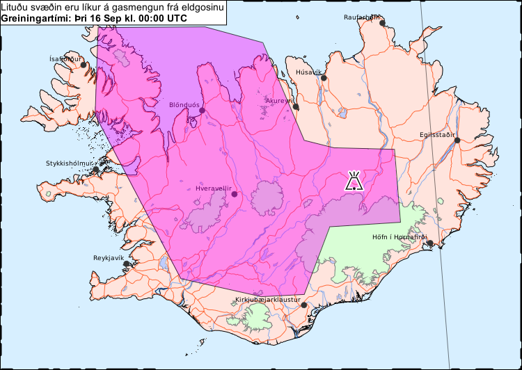
Litaða svæðið sýnir líklega gasmengun á morgun, fimmtudaginn 18. september
The colored area is likely to show gas pollution tomorrow, Thursday 18 September.
Holuhraun (Askja) & Bárdarbunga, Iceland, 2014
Iceland Meteorological Office (IMO). (2014). Litaða svæðið sýnir líklega gasmengun á morgun, fimmtudaginn 18. september.
This map was produced by an official agency, but is NOT the most recent, most complete, or main operational map.
For the current operational hazard map, please consult the proper institutional authorities.
Click on image for full-size map. If link seems broken, try the archived version.
Iceland Met Office (IMO). (2014-2015). Gas dreifingarspá. 16 Sep 2014-12 Dec 2014Map Set
http://avd.is/is/?cat=17
Other Maps In Set: