
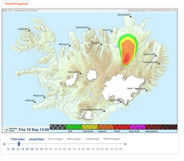
Gasdreifingarspá. Magn SO2 í andrúmslofti við yfirborð. Fös 19 Sept 13:00
Gas distribution forecast. Amount of SO2 in atmosphere at surface. Fri 19 Sept 13:00
Holuhraun (Askja) & Bárdarbunga, Iceland, 2014
Iceland Meteorological Office (IMO). (2014). Gasdreifingarspá. Magn SO2 í andrúmslofti við yfirborð. Fös 19 Sept 13:00
This map was produced by an official agency, but is NOT the most recent, most complete, or main operational map.
For the current operational hazard map, please consult the proper institutional authorities.
Click on image for full-size map. If link seems broken, try the archived version.
Iceland Met Office (IMO). (2014-2015). Gas dreifingarspá. 16 Sep 2014-12 Dec 2014Map Set
http://avd.is/is/?cat=17
Other Maps In Set: