
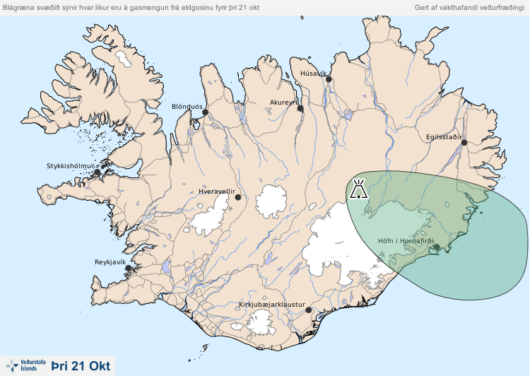
Blágræna svæðið sýnir hvar líkur eru á gasmengun frá eldgosinu fyrir mið þri 21 okt.
The blue-green area shows the probability of gas pollution from the volcanic eruption by Mon Oct 21.
Holuhraun (Askja) & Bárdarbunga, Iceland, 2014
Iceland Meteorological Office (IMO). (2014). Blágræna svæðið sýnir hvar líkur eru á gasmengun frá eldgosinu fyrir mið þri 21 okt.
This map was produced by an official agency, but is NOT the most recent, most complete, or main operational map.
For the current operational hazard map, please consult the proper institutional authorities.
Click on image for full-size map. If link seems broken, try the archived version.
Iceland Met Office (IMO). (2014-2015). Gas dreifingarspá. 16 Sep 2014-12 Dec 2014Map Set
http://avd.is/is/?cat=17
Other Maps In Set: