
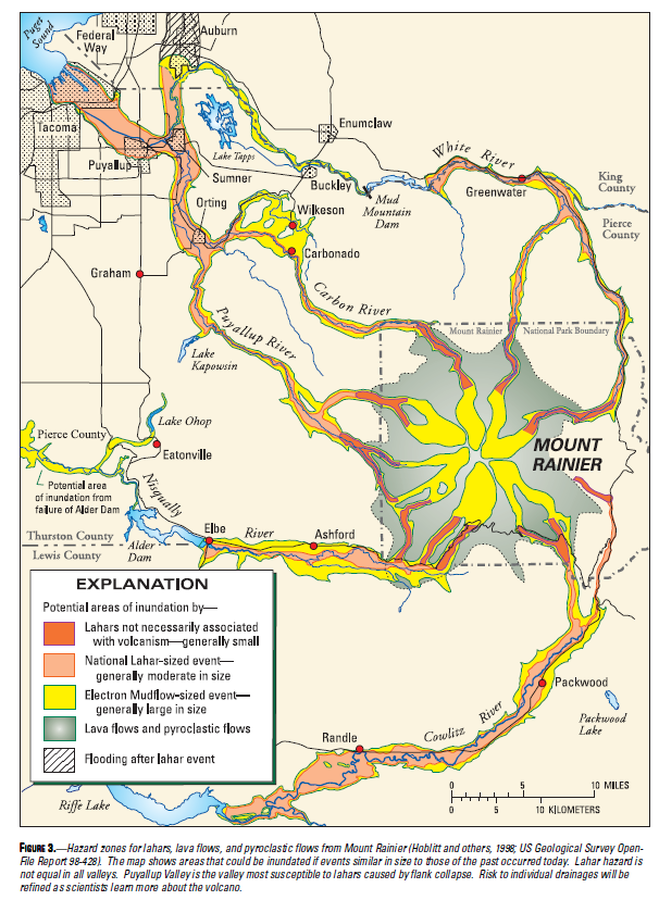
Hazard zones for lahars, lava flows, and pyroclastic flows from Mount Rainier
Rainier, United States, 2002
Figure 3 in: Driedger, C.L. & Scott, K.M. (2002). Mount Rainier: learning to live with volcanic risk. U.S. Geological Survey, Fact Sheet 034-02, 4 p. https://doi.org/10.3133/fs03402
This map was produced by an official agency, but is NOT the most recent, most complete, or main operational map.
For the current operational hazard map, please consult the proper institutional authorities.
Click on image for full-size map. If link seems broken, try the archived version.
Driedger, C.L. & Scott, K.M. (2002). Mount Rainier: learning to live with volcanic risk. U.S. Geological Survey, Fact Sheet 034-02, 4 p. https://doi.org/10.3133/fs03402Map Set
https://doi.org/10.3133/fs03402
Other Maps In Set: