← Back to Search Results

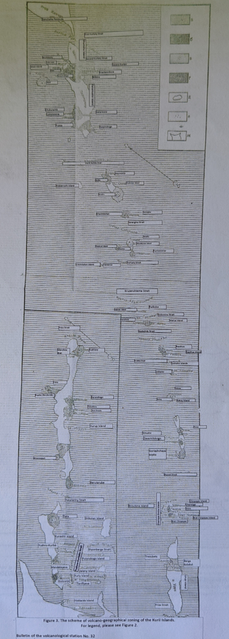
Scheme of volcano-geographical zoning in the Kuril Islands

Kuril Islands (regional), Japan, Russia, 1962

Figure 3 in: Markhinin, E. K., Sirin, A. N., Timerbayeva, K. M., & Tokarev, P. I. (1962). Experience of volcanic-geographic zoning of Kamchatka and Kuril Islands. Bulletin of the Volcanological Station, Petropavlousk, Kamchatskiy, USSR, 32, 52-70.


This map was produced by an official agency, but is NOT the most recent, most complete, or main operational map. For the current operational hazard map, please consult the proper institutional authorities.

Map Set

Markhinin, E. K., Sirin, A. N., Timerbayeva, K. M., & Tokarev, P. I. (1962). Experience of volcanic-geographic zoning of Kamchatka and Kuril Islands. Bulletin of the Volcanological Station, Petropavlousk, Kamchatskiy, USSR, 32, 52-70.

Map Data

Map ID1440
Hazard Process(es)Lahars; Unstated or all hazards; Vent-opening hazards
Hazard Zone PresentationGrouped by process (e.g. flowage/fall hazards) on a main map panel
Temporal ScaleBackground, or long-term, map
Spatial ScaleRegional
Publication FormatFigure in a journal article
Zonation Method(s)Geologic history
Zonation Model(s)
Scenario(s) ConsideredMost-likely
Hazard Zone Label(s)Hazard process name; Location or source name; Recurrence interval
Probability Definition(s)Qualitative relative probability (e.g. high-medium-low); Recurrence interval
PurposeScientific interest: Intended for scientific research and general scientific interest; usually published in academic journals
AudienceScientists (usually in scientific publication)
Language(s)English (translated); Russian
Basemap(s)Simple or sketch map
Basemap overlay(s)
DiemsionalityPlanimetric (2D or map) view
Color SchemeDark to Light (color)