
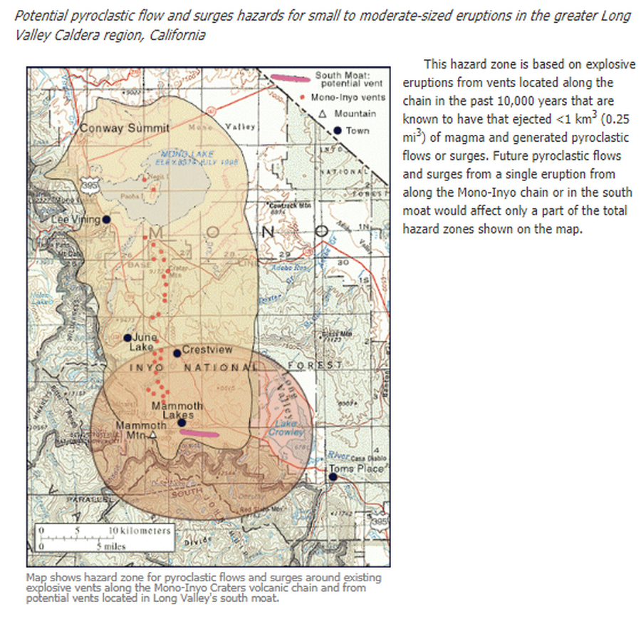
Map shows hazard zone for pyroclastic flows and surges around existing explosive vents along the Mono-Inyo Craters volcanic chain and from potential vents located in Long Valley's south moat
Long Valley-Mono-Inyo Craters Area, United States, 2012
U.S. Geological Survey (USGS). (2012). Map shows hazard zone for pyroclastic flows and surges around existing explosive vents along the Mono-Inyo Craters volcanic chain and from potential vents located in Long Valley's south moat. U.S. Geological Survey. Long Valley Caldera Hazards, Pyroclastic Flow and Surge Hazard Zones from Potential Vents in Long Valley Caldera, California. https://www.usgs.gov/volcanoes/long-valley-caldera/pyroclastic-flow-and-surge-hazard-zones-potential-vents-long-valley
This map was produced by an official agency, but may not be the most recent, most complete, or main operational map.
For the current operational hazard map, please consult the proper institutional authorities.
Click on image for full-size map. If link seems broken, try the archived version.
U.S. Geological Survey. (2012). Long Valley Caldera, Volcano Hazards in the Long Valley - Mono Lake Area, California. https://www.usgs.gov/volcanoes/long-valley-caldera/volcano-hazards-long-valley-mono-lake-area-california Map Set
https://volcanoes.usgs.gov/volcanoes/long_valley/hazard_hazards.html
Other Maps In Set: