
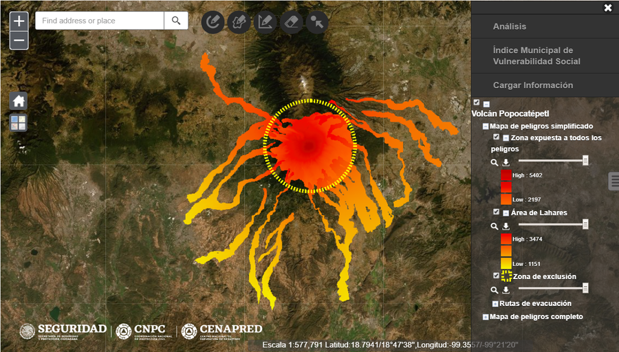
Mapa de Peligros del Volcán Popocatépetl
Popocatepetl Volcano Hazard Map
Popocatépetl, Mexico, Year unknown
Secretaría de Seguridad y Protección Ciudadana, Coordinación Nacional de Protección Civil (CNPC), & Centro Nacional de Prevención de Desastres (CENEPRED). Mapa de Peligros del Volcán Popocatépetl. Gobierno de México.
This map was produced by an official agency, but may not be the most recent, most complete, or main operational map.
For the current operational hazard map, please consult the proper institutional authorities.
Click on image for full-size map. If link seems broken, try the archived version.