← Back to Search Results

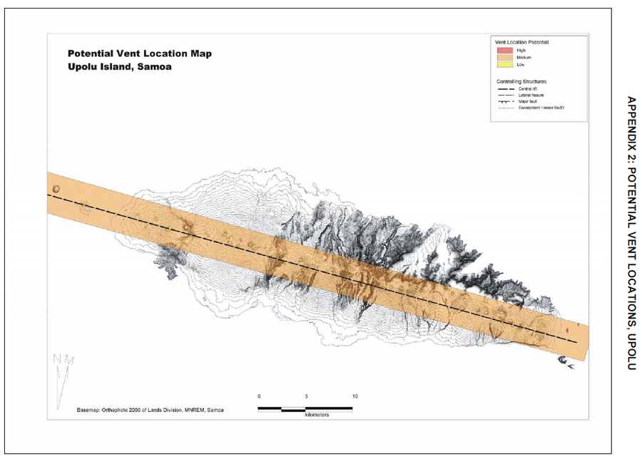
Potential Vent Locations Map, Upolu Island, Samoa

Upolu, Samoa, 2006

Appendix 2 in: Cronin, S., Bonte-Grapentin, M. & Nemeth, K. (2006). Samoa technical report - Review of volcanic hazard maps for Savai'i and Upolu. Pacific Islands Applied Geoscience Commission (SOPAC) Project Report 59.


This map was produced by an official agency, but may not be the most recent, most complete, or main operational map. For the current operational hazard map, please consult the proper institutional authorities.


Click on image for full-size map. If link seems broken, try the archived version.

Map Set

Cronin, S., Bonte-Grapentin, M. & Nemeth, K. (2006). Samoa technical report - Review of volcanic hazard maps for Savai'i and Upolu. EU-SOPAC Project Report 59.
https://mro.massey.ac.nz/handle/10179/7724

Other Maps In Set:

Map Data

Map ID1470
Hazard Process(es)Vent-opening hazards
Hazard Zone PresentationSingle hazard: A single hazard process is represented on a main map panel
Temporal ScaleBackground, or long-term, map
Spatial ScaleIsland
Publication FormatFigure in a hazard assessment or mitigation plan
Zonation Method(s)Geologic history
Zonation Model(s)
Scenario(s) ConsideredSource location or direction
Hazard Zone Label(s)Qualitative relative probability (e.g. high-medium-low)
Probability Definition(s)Qualitative relative probability (e.g. high-medium-low)
PurposeMultiple: intended for multiple purposes including general hazard awareness, planning, and crisis management
AudienceMultiple audiences (usually the public, civil authorities, and land-use planners)
Language(s)English
Basemap(s)Contour lines
Basemap overlay(s)
DiemsionalityPlanimetric (2D or map) view
Color SchemeRed to Yellow
Go to Global Volcanism Program page for Upolu →