
Map at 1:75,000 scale depicting the results of forward modeling
Lascar, Chile, 2017
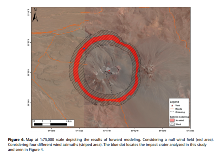
Figure 6 in: Bertin, D. (2017). 3‐D ballistic transport of ellipsoidal volcanic projectiles considering horizontal wind field and variable shape‐dependent drag coefficients. Journal of Geophysical Research: Solid Earth, 122(2), p. 1126-1151. https://doi.org/10.1002/2016JB013320
This hazard map is the result of scientific research and was published in academic literature.
It is presented here to serve as an example of the map type or the map-making methodology. It is NOT the official, operational map. For the current operational hazard map, please consult the proper institutional authorities.
Click on image for full-size map.
Map Set
Bertin, D. (2017). 3‐D ballistic transport of ellipsoidal volcanic projectiles considering horizontal wind field and variable shape‐dependent drag coefficients. Journal of Geophysical Research: Solid Earth, 122(2), p. 1126-1151. https://doi.org/10.1002/2016JB013320
https://doi.org/10.1002/2016JB013320
Other Maps In Set: