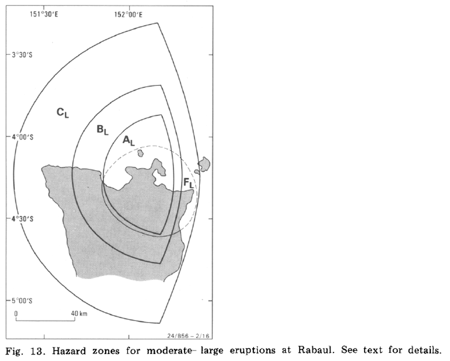
Hazard zones for moderate-large eruptions at Rabaul
Rabaul, Papua New Guinea, 1985
Figure 13 in: McKee, C. O., Johnson, R. W., Lowenstein, P. L., Riley, S. J., Blong, R. J., De Saint Ours, P., & Talai, B. (1985). Rabaul caldera, Papua New Guinea: volcanic hazards, surveillance, and eruption contingency planning. Journal of Volcanology and Geothermal Research, 23(3-4), p. 195-237. https://doi.org/10.1016/0377-0273(85)90035-6
This map was produced by an official agency, but is NOT the most recent, most complete, or main operational map.
For the current operational hazard map, please consult the proper institutional authorities.

Click on image for full-size map.
Map Set
McKee, C. O., Johnson, R. W., Lowenstein, P. L., Riley, S. J., Blong, R. J., De Saint Ours, P., & Talai, B. (1985). Rabaul caldera, Papua New Guinea: volcanic hazards, surveillance, and eruption contingency planning. Journal of Volcanology and Geothermal Research, 23(3-4), p. 195-237. https://doi.org/10.1016/0377-0273(85)90035-6
https://doi.org/10.1016/0377-0273(85)90035-6
Other Maps In Set:
- Idealized tephra fallout patterns from a 20-km-high eruption column from a source at Tavurvur volcano
- Idealized predicted tephra fallout patterns from 3-, 5-, and 10-km eruption columns from a source at Tavurvur volcano
- Hazard zones for small--moderate eruptions at Rabaul
- Tsunami hazard zone around Simpson Harbour for small--moderate eruptions
