
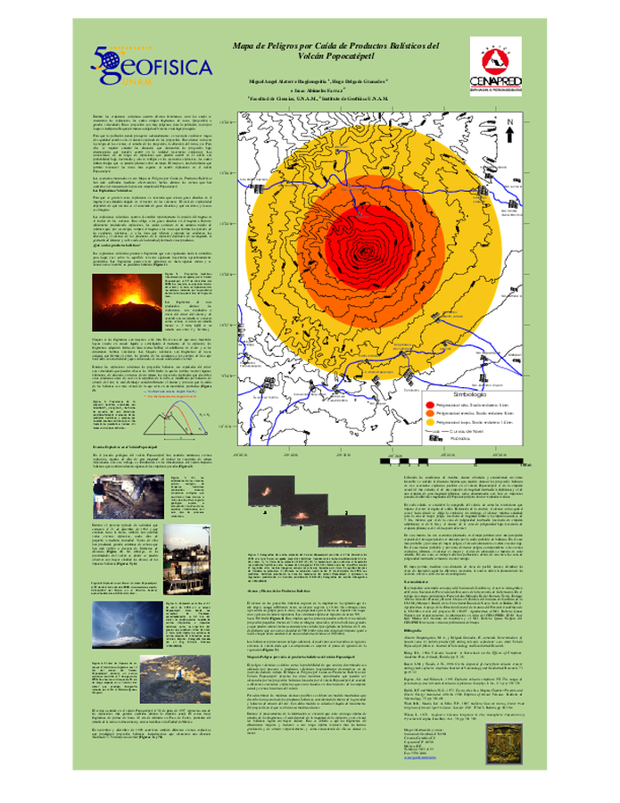
Mapa de Peligros por Caída de Productos Balísticos del Volcán Popocatépetl
Popocatépetl Volcano Ballistic Fall Products Hazard Map
Popocatépetl, Mexico, 2001
Alatorre-Ibargüengoitia, M. A., Delgado-Granados, H., & Abimelec-Farraz, I. (2001). Mapa de Peligros por Caída de Productos Balísticos del Volcán Popocatépetl. Instituto de Geofísica, UNAM, y Centro Nacional de Prevención de Desastres (CENAPRED), México.
This map was produced by an official agency, but is NOT the most recent, most complete, or main operational map.
For the current operational hazard map, please consult the proper institutional authorities.
Click on image for full-size map.