← Back to Search Results

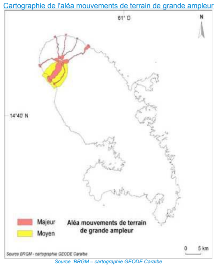
Cartographie de l'Aléa Mouvements de Terrain de Grande Ampleur

Map of the Hazards from Large-scale Land Movements

Pelée, Martinique [France], 2014

Page 72 in: Préfet de la Martinique. (2014). Dossier Départemental des Risques Majeurs en Martinique. DDRM 972.


This map was produced by an official agency, but may not be the most recent, most complete, or main operational map. For the current operational hazard map, please consult the proper institutional authorities.


Click on image for full-size map. If link seems broken, try the archived version.

Map Set

Préfet de la Martinique. (2014). Dossier Départemental des Risques Majeurs en Martinique. DDRM 972.
http://www.martinique.gouv.fr/content/download/9321/73171/file/DDRM%20972_20%20janvier%202014.pdf

Other Maps In Set:

Map Data

Map ID1510
Hazard Process(es)Debris avalanches
Hazard Zone PresentationSingle hazard: A single hazard process is represented on a main map panel
Temporal ScaleBackground, or long-term, map
Spatial ScaleIsland
Publication FormatFigure in a hazard assessment or mitigation plan
Zonation Method(s)Geologic history
Zonation Model(s)
Scenario(s) ConsideredNo scenarios were discernable from the map
Hazard Zone Label(s)Qualitative relative probability (e.g. high-medium-low)
Probability Definition(s)Qualitative relative probability (e.g. high-medium-low)
PurposeLand-use planning: Intended to inform citing of facilities, building restrictions, resource management, and infrastructure development
AudienceMultiple audiences (usually the public, civil authorities, and land-use planners)
Language(s)French
Basemap(s)Simple or sketch map
Basemap overlay(s)
DiemsionalityPlanimetric (2D or map) view
Color SchemeRed to Yellow
Go to Global Volcanism Program page for Pelée →