← Back to Search Results

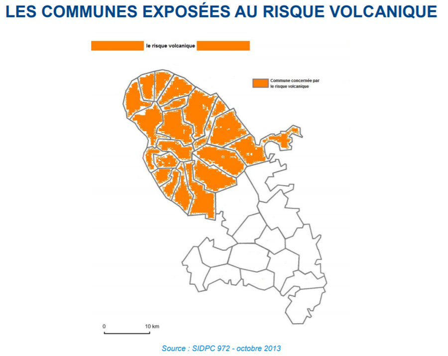
Les Communes Exposées au Risque Volcanique

Municipalities Exposed to Volcanic Risk

Pelée, Martinique [France], 2014

Page 75 in: Préfet de la Martinique. (2014). Dossier Départemental des Risques Majeurs en Martinique. DDRM 972.


This map was produced by an official agency, but may not be the most recent, most complete, or main operational map. For the current operational hazard map, please consult the proper institutional authorities.


Click on image for full-size map. If link seems broken, try the archived version.

Map Set

Préfet de la Martinique. (2014). Dossier Départemental des Risques Majeurs en Martinique. DDRM 972.
http://www.martinique.gouv.fr/content/download/9321/73171/file/DDRM%20972_20%20janvier%202014.pdf

Other Maps In Set:

Map Data

Map ID1512
Hazard Process(es)Unstated or all hazards
Hazard Zone PresentationHazard level-focused: All or most hazards are combined by hazard level on a main map panel
Temporal ScaleBackground, or long-term, map
Spatial ScaleIsland
Publication FormatFigure in a hazard assessment or mitigation plan
Zonation Method(s)Geologic history
Zonation Model(s)
Scenario(s) ConsideredNo scenarios were discernable from the map
Hazard Zone Label(s)Access (exclusion, danger, or safe zones)
Probability Definition(s)No probability definition was discernable from the map
PurposeLand-use planning: Intended to inform citing of facilities, building restrictions, resource management, and infrastructure development
AudienceMultiple audiences (usually the public, civil authorities, and land-use planners)
Language(s)French
Basemap(s)Administrative boundaries (e.g. county, park, intl.)
Basemap overlay(s)
DiemsionalityPlanimetric (2D or map) view
Color SchemeSingle color
Go to Global Volcanism Program page for Pelée →