← Back to Search Results

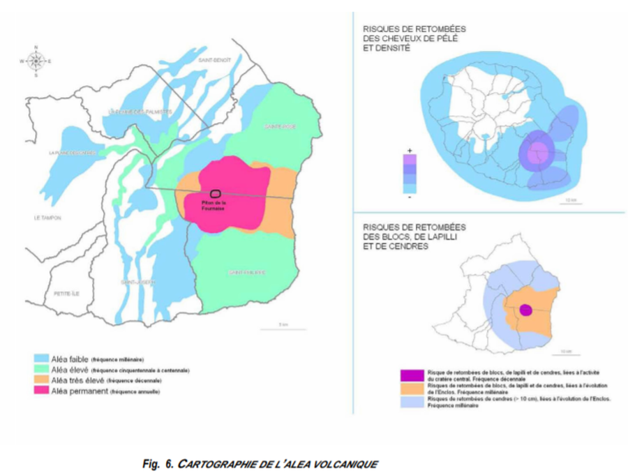
Cartographie de l’Alea Volcanique

Mapping of the Volcanic Hazard

Piton de la Fournaise, Reunion Island [France], 2012

Figure 6 in: Préfet de la Région Réunion. (2012). Schema de Prevention des Risques Naturels de la Réunion. Diagnostic et Programme d’Actions.


This map was produced by an official agency, but may not be the most recent, most complete, or main operational map. For the current operational hazard map, please consult the proper institutional authorities.


Click on image for full-size map. If link seems broken, try the archived version.

Map Data

Map ID1514
Hazard Process(es)Ballistics; Tephra fall; Unstated or all hazards
Hazard Zone PresentationHazard level- and process-focused: Hazards are both combined by hazard level and separated by hazard process type on a main map and series of insets
Temporal ScaleBackground, or long-term, map
Spatial ScaleVolcano and surrounding area
Publication FormatFigure in a hazard assessment or mitigation plan
Zonation Method(s)Geologic history
Zonation Model(s)
Scenario(s) ConsideredSource location or direction
Hazard Zone Label(s)Qualitative relative probability (e.g. high-medium-low)
Probability Definition(s)Recurrence interval
PurposeLand-use planning: Intended to inform citing of facilities, building restrictions, resource management, and infrastructure development
AudienceMultiple audiences (usually the public, civil authorities, and land-use planners)
Language(s)French
Basemap(s)Administrative boundaries (e.g. county, park, intl.)
Basemap overlay(s)
DiemsionalityPlanimetric (2D or map) view
Color SchemeRainbow
Go to Global Volcanism Program page for Piton de la Fournaise →