
Ash-fall hazard map
La Palma, Spain, 2019
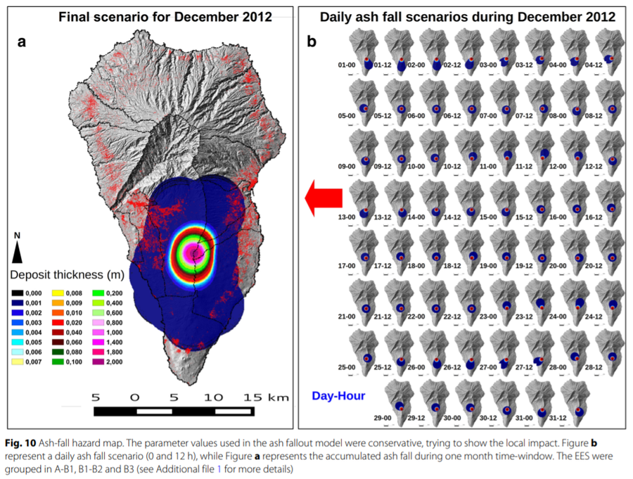
Figure 10 in: Marrero, J. M., García, A., Berrocoso, M., Llinares, Á., Rodríguez-Losada, A., & Ortiz, R. (2019). Strategies for the development of volcanic hazard maps in monogenetic volcanic fields: the example of La Palma (Canary Islands). Journal of Applied Volcanology, 8(1), 6. https://doi.org/10.1186/s13617-019-0085-5
This hazard map is the result of scientific research and was published in academic literature.
It is presented here to serve as an example of the map type or the map-making methodology. It is NOT the official, operational map. For the current operational hazard map, please consult the proper institutional authorities.
Click on image for full-size map. If link seems broken, try the archived version.
Marrero, J. M., García, A., Berrocoso, M., Llinares, Á., Rodríguez-Losada, A., & Ortiz, R. (2019). Strategies for the development of volcanic hazard maps in monogenetic volcanic fields: the example of La Palma (Canary Islands). Journal of Applied Volcanology, 8(1), 6. https://doi.org/10.1186/s13617-019-0085-5Map Set
https://doi.org/10.1186/s13617-019-0085-5
Other Maps In Set: