
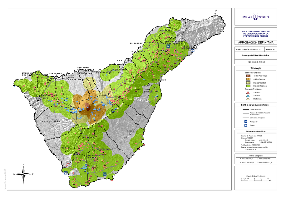
Tipología Eruptiva
Eruptive Type
Tenerife, Spain, 2012
Map II.2.7 in: Cabildo Tenerife. (2012). Plan Territorial Especial de Ordenación para la Prevención de Riesgos. Documento Cartográfico (Planos de Información).
This map was produced by an official agency, but may not be the most recent, most complete, or main operational map.
For the current operational hazard map, please consult the proper institutional authorities.
Click on image for full-size map. If link seems broken, try the archived version.
Cabildo Tenerife. (2012). Plan Territorial Especial de Ordemación para la Prevención de Riesgos. Documento Cartográfocp (Planos de Información). Map Set
https://www.tenerife.es/planes/PTEOPrevRiesgos/PTEOPrevindex.htm
Other Maps In Set: