
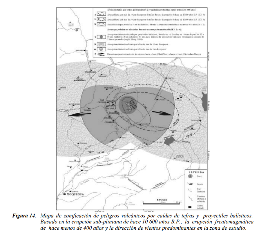
Mapa de zonificación de peligros volcánicos por caídas de tefras y proyectiles balísticos
Zoning map of volcanic hazards from falling tephra and ballistic projectiles
Ticsani, Peru, 2003
Figure 14 in: Mariño Salazar, J. & Thouret, J.-C. (2003). Geología, Historia Eruptiva y Evaluación de Peligros del Volcán Ticsani (Sur del Perú). Instituto Geofísico del Perú (IGP).
This map was produced by an official agency, but is NOT the most recent, most complete, or main operational map.
For the current operational hazard map, please consult the proper institutional authorities.
Click on image for full-size map. If link seems broken, try the archived version.
Mariño Salazar, J. & Thouret, J.-C. (2003). Geología, Historia Eruptiva y Evaluación de Peligros del Volcán Ticsani (Sur del Perú). Instituto Geofísico del Perú (IGP).Map Set
http://sigrid.cenepred.gob.pe/sigridv3/documento/150
Other Maps In Set: