
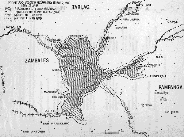
Pinatubo Volcano Preliminary Hazard Map (May 23, 1991)
Pinatubo, Philippines, 1991
Figure 5 in: Punongbayan, R.S., Newhall, C.G., Bautista, L.P., Garcia, D., Harlow, D.H., Hoblitt, R.P., Sabit, J.P., & Solidum, R.U. (1996). Eruption hazard assessments and warnings. In: Newhall, C.G. & Punongbayan, R.S. (Eds.) Fire and Mud: Eruptions and Lahars of Mount Pinatubo, Philippines. Philippine Institute of Volcanology and Seismology, Quezon City; University of Washington Press, Seattle.
This map was produced by an official agency, but is NOT the most recent, most complete, or main operational map.
For the current operational hazard map, please consult the proper institutional authorities.
Click on image for full-size map. If link seems broken, try the archived version.
Punongbayan, R.S., Newhall, C.G., Bautista, L.P., Garcia, D., Harlow, D.H., Hoblitt, R.P., Sabit, J.P., & Solidum, R.U. (1996). Eruption hazard assessments and warnings. In: Newhall, C.G. & Punongbayan, R.S. (Eds.) Fire and Mud: Eruptions and Lahars of Mount Pinatubo, Philippines. Philippine Institute of Volcanology and Seismology, Quezon City; University of Washington Press,
Seattle.Map Set
https://pubs.usgs.gov/pinatubo/punong2/
Other Maps In Set: