
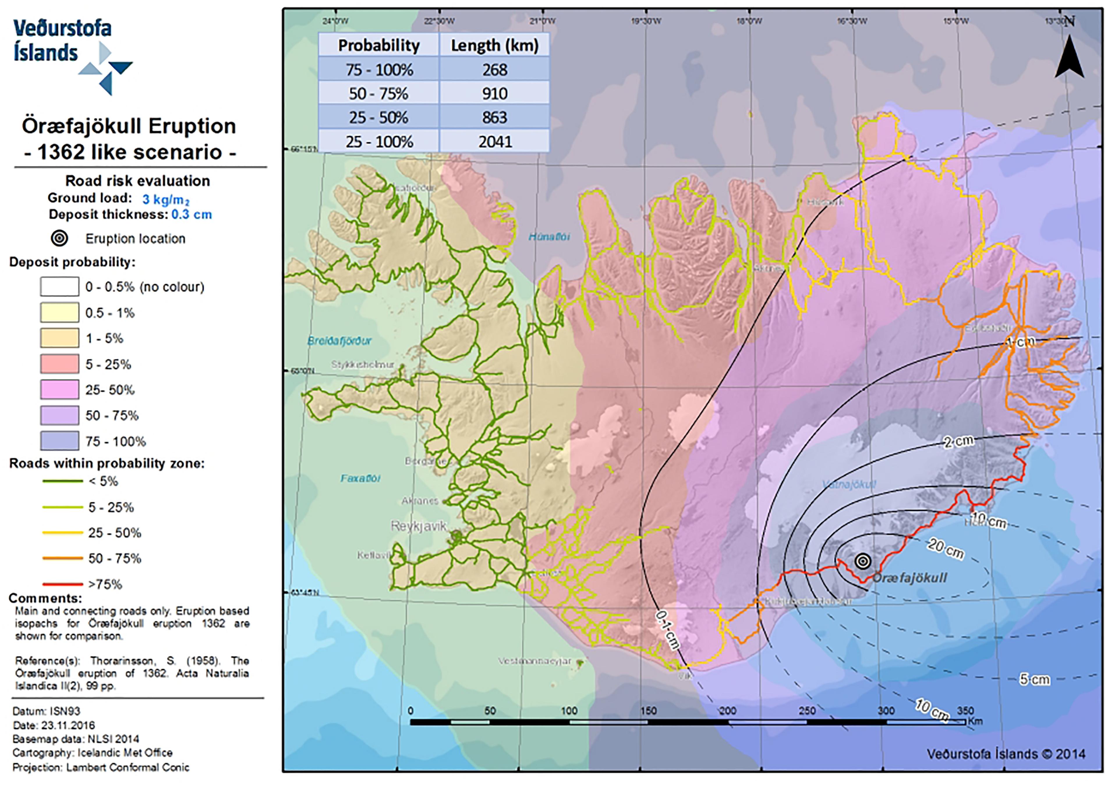
Map showing potential impact of tephra fallout to roads in case of a 1362-like eruption at Öræfajökull
Öræfajökull, Iceland, 2018
Figure 9 in: Barsotti, S., Di Rienzo, D. I., Thordarson, T., Björnsson, B. B., & Karlsdóttir, S. (2018). Assessing impact to infrastructures due to tephra fallout from Öræfajökull volcano (Iceland) by using a scenario-based approach and a numerical model. Frontiers in Earth Science, 6, 196. https://doi.org/10.3389/feart.2018.00196
This hazard map is the result of scientific research and was published in academic literature.
It is presented here to serve as an example of the map type or the map-making methodology. It is NOT the official, operational map. For the current operational hazard map, please consult the proper institutional authorities.
Click on image for full-size map. If link seems broken, try the archived version.
Barsotti, S., Di Rienzo, D. I., Thordarson, T., Björnsson, B. B., & Karlsdóttir, S. (2018). Assessing impact to infrastructures due to tephra fallout from Öræfajökull volcano (Iceland) by using a scenario-based approach and a numerical model. Frontiers in Earth Science, 6, 196. https://doi.org/10.3389/feart.2018.00196Map Set
https://doi.org/10.3389/feart.2018.00196
Other Maps In Set: