
Volcanic hazard areas for hypothesised accumulation of pyroclastic density current deposits
Campi Flegrei, Italy, 2001
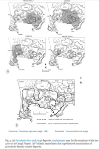
Figure 4 in: Lirer, L., Petrosino, P., & Alberico, I. (2001). Hazard assessment at volcanic fields: the Campi Flegrei case history. Journal of volcanology and geothermal research, 112(1-4), p. 53-73. https://doi.org/10.1016/S0377-0273(01)00234-7
This hazard map is the result of scientific research and was published in academic literature.
It is presented here to serve as an example of the map type or the map-making methodology. It is NOT the official, operational map. For the current operational hazard map, please consult the proper institutional authorities.
Click on thumbnail for full-size map. We do not have copyright permission to display the full-size image. If you are the copyright holder and wish to provide copyright, please contact us at admin@volcanichazardmaps.org.