← Back to Search Results

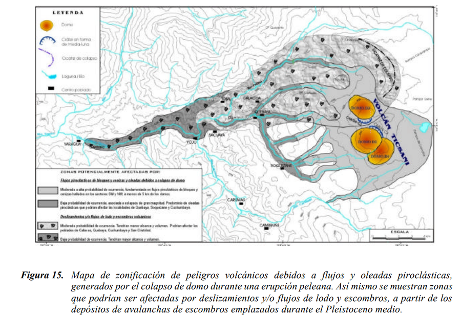
Mapa de zonificación de peligros volcánicos debidos a flujos y oleadas piroclásticas, generados por el colapso de domo durante una erupción peleana

Zoning map of volcanic hazards due to pyroclastic flows and surges, generated by the collapse of the dome during a Pelean eruption

Ticsani, Peru, 2003

Figure 15 in: Mariño Salazar, J. & Thouret, J.-C. (2003). Geología, Historia Eruptiva y Evaluación de Peligros del Volcán Ticsani (Sur del Perú). Instituto Geofísico del Perú (IGP).


This map was produced by an official agency, but is NOT the most recent, most complete, or main operational map. For the current operational hazard map, please consult the proper institutional authorities.


Click on image for full-size map. If link seems broken, try the archived version.

Map Set

Mariño Salazar, J. & Thouret, J.-C. (2003). Geología, Historia Eruptiva y Evaluación de Peligros del Volcán Ticsani (Sur del Perú). Instituto Geofísico del Perú (IGP).
http://sigrid.cenepred.gob.pe/sigridv3/documento/150

Other Maps In Set:

Map Data

Map ID1613
Hazard Process(es)Debris avalanches; Lahars; PDCs; Surges
Hazard Zone PresentationHazard process-focused: Most hazard processes are separated by hazard process type on a main map panel
Temporal ScaleBackground, or long-term, map
Spatial ScaleVolcano and surrounding area
Publication FormatFigure in a hazard assessment or mitigation plan
Zonation Method(s)Geologic history
Zonation Model(s)
Scenario(s) ConsideredSize, VEI, or intensity; Style or type
Hazard Zone Label(s)Hazard process name
Probability Definition(s)Qualitative relative probability (e.g. high-medium-low)
PurposeMultiple: intended for multiple purposes including general hazard awareness, planning, and crisis management
AudienceMultiple audiences (usually the public, civil authorities, and land-use planners)
Language(s)Spanish
Basemap(s)Contour lines
Basemap overlay(s)
DiemsionalityPlanimetric (2D or map) view
Color SchemeDark to Light (greyscale)
Go to Global Volcanism Program page for Ticsani →