← Back to Search Results

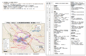
Hakkodasan (Odake crater) eruption warning regulation map (volcanic alert level 3)

Hakkodasan, Japan, 2019

Figure 3-3 in: Hakkodasan Volcanic Hazards Mitigation Committee. (2019). Hakkoda volcano evacuation plan. Aomori Prefecture, Aomori City, Towada City, Kuroishi City, and Hirakawa City.


This map was produced by an official agency, but may not be the most recent, most complete, or main operational map. For the current operational hazard map, please consult the proper institutional authorities.


Click on thumbnail for full-size map. We do not have copyright permission to display the full-size image. If you are the copyright holder and wish to provide copyright, please contact us at admin@volcanichazardmaps.org. If link seems broken, try the archived version.

Map Set

Hakkodasan Volcanic Hazards Mitigation Committee. (2019). Hakkoda volcano evacuation plan. Aomori Prefecture, Aomori City, Towada City, Kuroishi City, and Hirakawa City.
http://www.bousai.pref.aomori.jp/files/hakkouda_hinankeikaku.pdf

Other Maps In Set:

Map Data

Map ID3137
Hazard Process(es)Access or danger zone; Lahars; Lava flows; PDCs; Surges
Hazard Zone PresentationHazard level- and process-focused: Hazards are both combined by hazard level and separated by hazard process type on a main map panel
Temporal ScaleBackground, or long-term, map
Spatial ScaleVolcano and surrounding area
Publication FormatFigure in a hazard assessment or mitigation plan
Zonation Method(s)Derived/simplified from another map
Zonation Model(s)
Scenario(s) ConsideredAlert levels
Hazard Zone Label(s)Access (exclusion, danger, or safe zones); Hazard process name
Probability Definition(s)Alert levels imply probability
PurposeCrisis management and response: Intended to be used for managing, responding to, and taking action during an eruption; often includes evacuation routes, access restrictions, actions to take, etc.
AudienceMultiple audiences (usually the public, civil authorities, and land-use planners)
Language(s)Japanese
Basemap(s)Hillshade
Basemap overlay(s)Contour lines; Trail or hiking map
DiemsionalityPlanimetric (2D or map) view
Color SchemeCategorical/Qualitative
Go to Global Volcanism Program page for Hakkodasan →