
Volcanic disaster prevention map of Zaozan volcano [Yamagata version]
Zaozan [Zaosan], Japan, 2017
Volcano Disaster Management Councils of Zaozan Volcano. (2017). Volcanic disaster prevention map of Zaozan volcano [Yamagata version]. Kawasaki Town, Zaou Town, Shiraishi City, Shichikashuku Town, Yamagata City, and Kaminoyama City.
This map was produced by an official agency, but may not be the most recent, most complete, or main operational map.
For the current operational hazard map, please consult the proper institutional authorities.
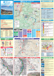
Click on thumbnail for full-size map. We do not have copyright permission to display the full-size image. If you are the copyright holder and wish to provide copyright, please contact us at admin@volcanichazardmaps.org. If link seems broken, try the archived version.
Map Set
Map Data
Map ID 3191 Hazard Process(es) Ballistics; Debris avalanches (text only); Lahars; Lava flows (text only); Surges; Tephra fall; Vent-opening hazards Hazard Zone Presentation Hazard process-focused: Most hazard processes are separated by hazard process type on a main map and series of insets Temporal Scale Background, or long-term, map Spatial Scale Volcano and surrounding area Publication Format Map sheet or poster Zonation Method(s) Geologic history; Unknown modeling type Zonation Model(s) Scenario(s) Considered Season or weather; Size, VEI, or intensity; Specific past eruption; Style or type Hazard Zone Label(s) Estimated value or Hazard Impact Metric; Hazard process name Probability Definition(s) Scenarios imply probability Purpose Crisis management and response: Intended to be used for managing, responding to, and taking action during an eruption; often includes evacuation routes, access restrictions, actions to take, etc. Audience General public and/or media Language(s) Japanese Basemap(s) Topographic map (colored contour map) Basemap overlay(s) Contour lines; Street map Diemsionality Planimetric (2D or map) view Color Scheme Categorical/Qualitative Volcanic Alert Level System https://global-valid.org/val-japan-20/