← Back to Search Results

Kusatsu-Shiranesan Volcano Disaster Preventions Map

Kusatsu-Shiranesan, Japan, 1995

Kusatsu-Shirane Volcano Eruption Hazard Area Prediction Map Preparation Review Committee. (1995). Kusatsu-Shiranesan Volcano Disaster Preventions Map. Kusatsu Town, Marikoi Village, Naganomachi, and Rokugo Village.


This map was produced by an official agency, but is NOT the most recent, most complete, or main operational map. For the current operational hazard map, please consult the proper institutional authorities.


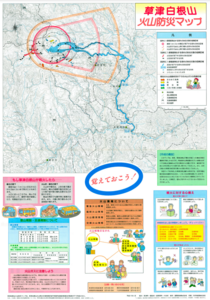
Click on thumbnail for full-size map. We do not have copyright permission to display the full-size image. If you are the copyright holder and wish to provide copyright, please contact us at admin@volcanichazardmaps.org. If link seems broken, try the archived version.

Map Data

Map ID3205
Hazard Process(es)Access or danger zone; Ballistics; Gas; Lahars
Hazard Zone PresentationHazard process-focused: Most hazard processes are separated by hazard process type on a main map panel
Temporal ScaleBackground, or long-term, map
Spatial ScaleVolcano and surrounding area
Publication FormatMap sheet or poster
Zonation Method(s)Geologic history; Unknown modeling type
Zonation Model(s)
Scenario(s) ConsideredAlert levels; Style or type
Hazard Zone Label(s)Access (exclusion, danger, or safe zones); Estimated value or Hazard Impact Metric; Hazard process name; Qualitative relative probability (e.g. high-medium-low)
Probability Definition(s)Alert levels imply probability; Qualitative relative probability (e.g. high-medium-low); Recurrence interval
PurposeCrisis management and response: Intended to be used for managing, responding to, and taking action during an eruption; often includes evacuation routes, access restrictions, actions to take, etc.
AudienceGeneral public and/or media
Language(s)Japanese
Basemap(s)Contour lines
Basemap overlay(s)Trail or hiking map
DiemsionalityPlanimetric (2D or map) view
Color SchemeRed to Green
Go to Global Volcanism Program page for Kusatsu-Shiranesan →