
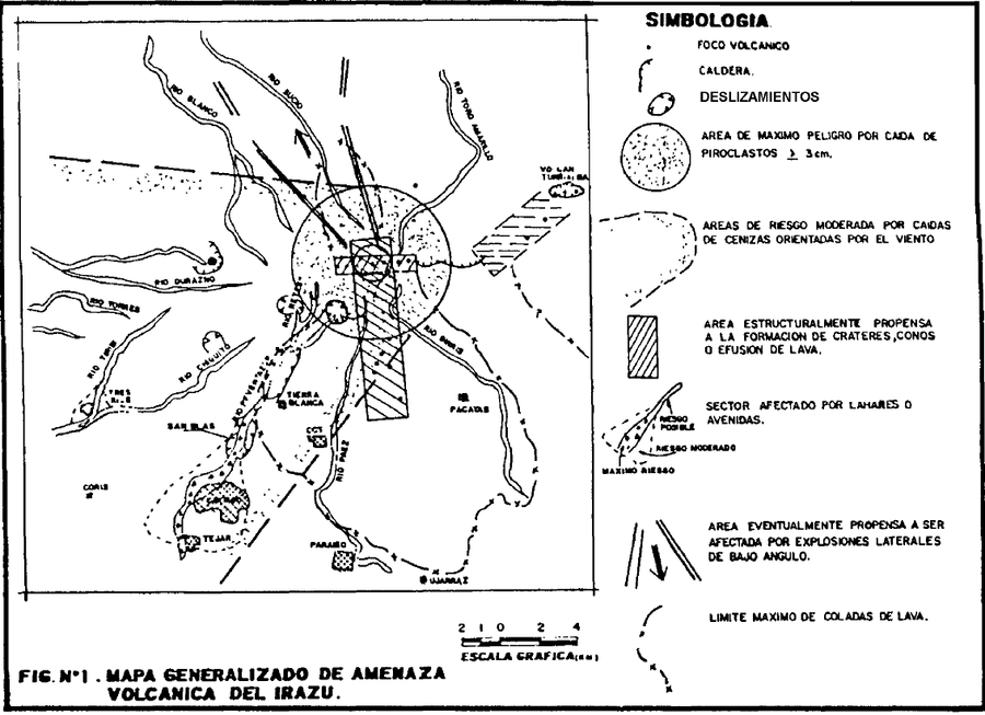
Mapa Generalizado de Amenaza Volcanica del Irazu
Generalized Irazu Volcanic Threat Map
Irazú, Costa Rica, 1988
Figure 1 in: Alvarado, G.E. & Boschini, I. (1988). Evaluación preliminar de las amenazas geológicas y periodos de recurrencia en el Valle del Guarco, Cartago: su eventual incidencia en el deslizamiento de San Blas. Cuarto Seminario Nacional de Geotecnia, San José, Costa Rica, 14 p.
This hazard map is the result of scientific research and was published in academic literature.
It is presented here to serve as an example of the map type or the map-making methodology. It is NOT the official, operational map. For the current operational hazard map, please consult the proper institutional authorities.
Click on image for full-size map. If link seems broken, try the archived version.
Alvarado, G.E. & Boschini, I. (1988). Evaluación preliminar de las amenazas geológicas y periodos de recurrencia en el Valle del Guarco, Cartago: su eventual incidencia en el deslizamiento de San Blas. Cuarto Seminario Nacional de Geotecnia, San José, Costa Rica, 14 p.Map Set
https://www.cne.go.cr/CEDO-CRID/pdf/spa/doc924/doc924-contenido.pdf