← Back to Search Results

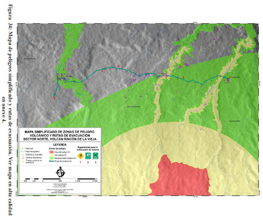
Mapa Simplificado de Zonas de Peligro Volcánico y Rutas de Evacuación Sector Norte, Volcán Rincón de la Vieja

Simplified Map of Volcanic Hazard Zones and Evacuation Routes North Sector, Rincón de la Vieja Volcano

Rincón de la Vieja, Costa Rica, 2018

Figure 34 in: Alpízar, Y. (2018). Mapa Preliminar de Peligros Volcánicos para el Volcán Rincón de la Vieja (Costa Rica): Descripción de un Escenario de Afectación por Lahares. Ciudad Universitaria Rodrigo Facio, Costa Rica. 160 p.


This hazard map is the result of scientific research and was published in academic literature. It is presented here to serve as an example of the map type or the map-making methodology. It is NOT the official, operational map. For the current operational hazard map, please consult the proper institutional authorities.


Click on image for full-size map. If link seems broken, try the archived version.

Map Set

Alpízar, Y. (2018). Mapa Preliminar de Peligros Volcánicos para el Volcán Rincón de la Vieja (Costa Rica): Descripción de un Escenario de Afectación por Lahares. Ciudad Universitaria Rodrigo Facio, Costa Rica. 160 p.
http://www.kerwa.ucr.ac.cr/handle/10669/80648

Other Maps In Set:

Map Data

Map ID3327
Hazard Process(es)Acid rain; Ballistics; Gas; Lahars; Lava flows; PDCs; Tephra fall
Hazard Zone PresentationHazard level-focused: All or most hazards are combined by hazard level on a main map panel
Temporal ScaleBackground, or long-term, map
Spatial ScalePart of volcano (flank or drainage)
Publication FormatFigure in a thesis or dissertation
Zonation Method(s)Derived/simplified from another map
Zonation Model(s)
Scenario(s) ConsideredNo scenarios were discernable from the map
Hazard Zone Label(s)Qualitative relative probability (e.g. high-medium-low)
Probability Definition(s)Qualitative relative probability (e.g. high-medium-low)
PurposeCrisis management and response: Intended to be used for managing, responding to, and taking action during an eruption; often includes evacuation routes, access restrictions, actions to take, etc.
AudienceMultiple audiences (usually the public, civil authorities, and land-use planners)
Language(s)Spanish
Basemap(s)Hillshade
Basemap overlay(s)Street map
DiemsionalityPlanimetric (2D or map) view
Color SchemeRed to Green
Go to Global Volcanism Program page for Rincón de la Vieja →