
Mapa Preliminar de Peligros del Volcan Tacana Guatemala/Mexico - Flujos de Lava y Nubes de Cenizas de Futuras Erupciones
Preliminary Hazard Map Tacana Volcano Guatemala/Mexico - Lava Flows and Ashcloud from Future Eruptions
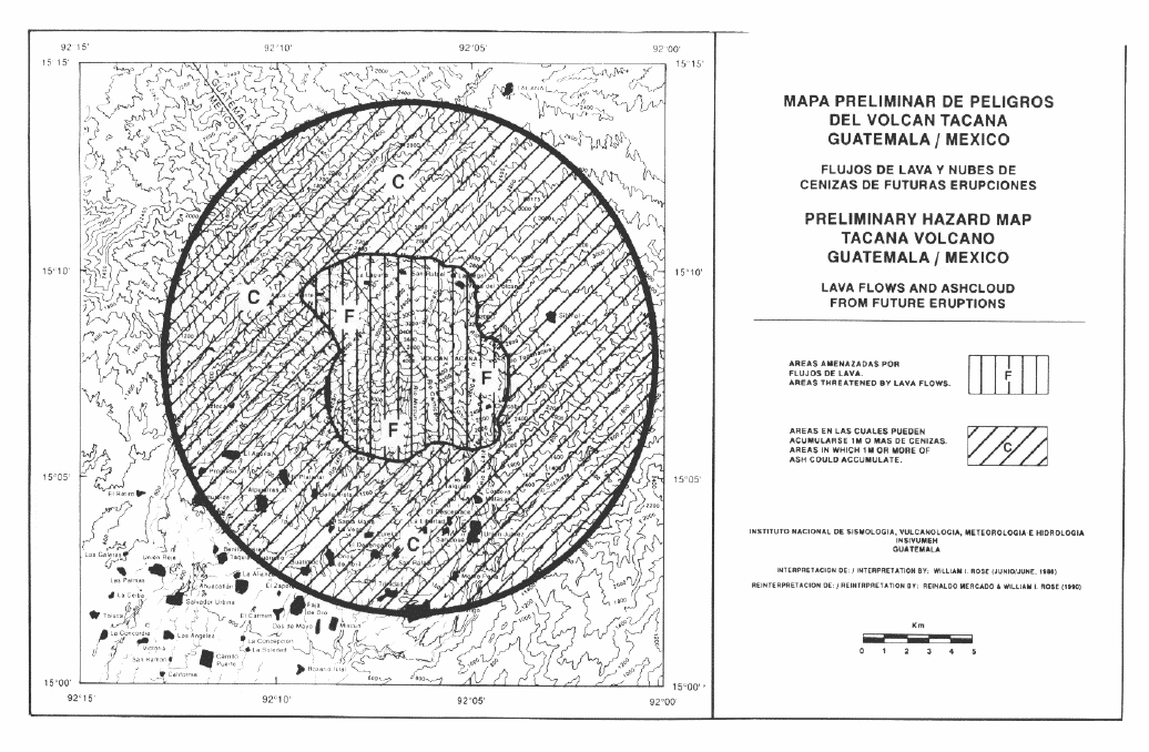
Tacaná, Mexico-Guatemala, 1992
Figure 6 in: Mercado, R., & Rose, W.I. (1992). Reconocimiento geologico y evaluación preliminar de peligrosidad del volcán Tacaná, Guatemala/Mexico. Geophysics International, 31 (3). p. 205-237
This hazard map is the result of scientific research and was published in academic literature.
It is presented here to serve as an example of the map type or the map-making methodology. It is NOT the official, operational map. For the current operational hazard map, please consult the proper institutional authorities.
Click on image for full-size map. If link seems broken, try the archived version.
Mercado, R., & Rose, W.I. (1992). Reconocimiento geologico y evaluación preliminar de peligrosidad del volcán Tacaná, Guatemala/Mexico. Geophysics International, 31 (3). p. 205-237Map Set
https://web.archive.org/web/20220629162946/http://revistagi.geofisica.unam.mx/index.php/RGI/article/view/1126/1105
Other Maps In Set: