
Mapas de peligros volcánicos
Volcanic hazard maps
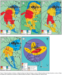
Nevado de Toluca, Mexico, 2006
Figure 3 in: Aceves-Quesada, F., López-Blanco, J., & Martin del Pozzo, A. L. (2006). Determinación de peligros volcánicos aplicando técnicas de evaluación multicriterio y SIG en el área del Nevado de Toluca, centro de México. Revista Mexicana de Ciencias Geológicas, 23(2), 113-124.
This hazard map is the result of scientific research and was published in academic literature.
It is presented here to serve as an example of the map type or the map-making methodology. It is NOT the official, operational map. For the current operational hazard map, please consult the proper institutional authorities.
Click on thumbnail for full-size map. We do not have copyright permission to display the full-size image. If you are the copyright holder and wish to provide copyright, please contact us at admin@volcanichazardmaps.org. If link seems broken, try the archived version.
Aceves-Quesada, F., López-Blanco, J., & Martin del Pozzo, A. L. (2006). Determinación de peligros volcánicos aplicando técnicas de evaluación multicriterio y SIG en el área del Nevado de Toluca, centro de México. Revista Mexicana de Ciencias Geológicas, 23(2), 113-124.Map Set
http://www.scielo.org.mx/scielo.php?pid=S1026-87742006000200001&script=sci_arttext
Other Maps In Set: