
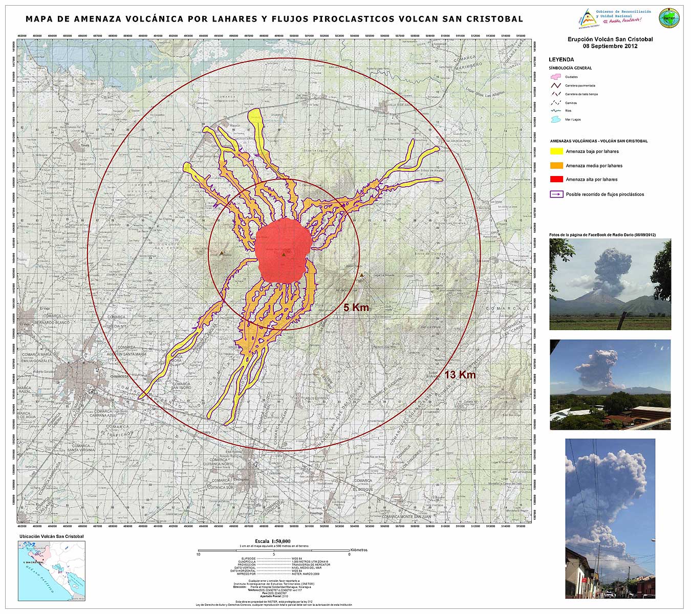
Mapa de Amenazas Volcánica por Lahares y Flujos Piroclasticos Volcan San Cristóbal
Map of Volcanic Hazards by Lahars and Pyroclastic Flows San Cristóbal Volcano
San Cristóbal, Nicaragua, 2012
Instituto Nicaragüense de Estudios Territoriales (INETER). (2012). Mapa de Amenazas Volcánica por Lahares y Flujos Piroclasticos Volcan San Cristóbal. Erupción Volcán San Cristóbal 08 Septiembre 2012.
This map was produced by an official agency, but is NOT the most recent, most complete, or main operational map.
For the current operational hazard map, please consult the proper institutional authorities.
Click on thumbnail for full-size map. We do not have copyright permission to display the full-size image. If you are the copyright holder and wish to provide copyright, please contact us at admin@volcanichazardmaps.org. If link seems broken, try the archived version.