← Back to Search Results

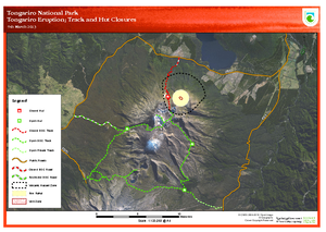
Tongariro Eruption Track and Hut Closures 9th March 2013

Tongariro, New Zealand, 2013

Department of Conservation. (2013). Tongariro Eruption; Track and Hut Closures. 9th March 2013.


This map was produced by an official agency, but is NOT the most recent, most complete, or main operational map. For the current operational hazard map, please consult the proper institutional authorities.


Click on thumbnail for full-size map. We do not have copyright permission to display the full-size image. If you are the copyright holder and wish to provide copyright, please contact us at admin@volcanichazardmaps.org. If link seems broken, try the archived version.

Map Data

Map ID3498
Hazard Process(es)Access or danger zone; Unstated or all hazards; Vent-opening hazards
Hazard Zone PresentationHazard level-focused: All or most hazards are combined by hazard level on a main map panel
Temporal ScaleCrisis, or short-term, map (hours to decades)
Spatial ScaleVolcano and surrounding area
Publication FormatSign or billboard
Zonation Method(s)Geologic history
Zonation Model(s)
Scenario(s) ConsideredCurrent conditions
Hazard Zone Label(s)Access (exclusion, danger, or safe zones)
Probability Definition(s)No probability definition was discernable from the map
PurposeCrisis management and response: Intended to be used for managing, responding to, and taking action during an eruption; often includes evacuation routes, access restrictions, actions to take, etc.
AudienceTourists or visitors (often for national parks or hiking trails)
Language(s)English
Basemap(s)Satellite image
Basemap overlay(s)Trail or hiking map
DiemsionalityPlanimetric (2D or map) view
Color SchemeRed to Green
Go to Global Volcanism Program page for Tongariro →