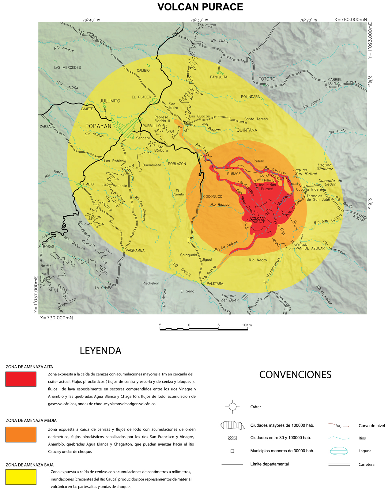
← Back to Search Results

Volcan Puracé

Puracé Volcano

Puracé, Colombia, 2012

Figure 2 (in reprint) in: Instituto Colombiano de Geología y Minería (INGEOMINAS). (2012). Volcán Puracé. (Reprinted in: Global Volcanism Program. (2012). Report on Purace (Colombia). In: Herrick, J.A. and Wunderman, R. (eds.). (2012). Bulletin of the Global Volcanism Network, 37:9. Smithsonian Institution. https://doi.org/10.5479/si.GVP.BGVN201209-351060)


This map was produced by an official agency, but is NOT the most recent, most complete, or main operational map. For the current operational hazard map, please consult the proper institutional authorities.


Click on image for full-size map. If link seems broken, try the archived version.

Map Data

Map ID3508
Hazard Process(es)Earthquakes; Floods or jokulhaups; Gas; Lahars; Lava flows; PDCs; Shockwaves; Tephra fall
Hazard Zone PresentationHazard level-focused: All or most hazards are combined by hazard level on a main map panel
Temporal ScaleBackground, or long-term, map
Spatial ScaleVolcano and surrounding area
Publication FormatUnknown format
Zonation Method(s)Geologic history
Zonation Model(s)
Scenario(s) ConsideredNo scenarios were discernable from the map
Hazard Zone Label(s)Qualitative relative probability (e.g. high-medium-low)
Probability Definition(s)Qualitative relative probability (e.g. high-medium-low)
PurposeMultiple: intended for multiple purposes including general hazard awareness, planning, and crisis management
AudienceMultiple audiences (usually the public, civil authorities, and land-use planners)
Language(s)Spanish
Basemap(s)Hillshade
Basemap overlay(s)Population map; Street map
DiemsionalityPlanimetric (2D or map) view
Color SchemeRed to Yellow
Go to Global Volcanism Program page for Puracé →