
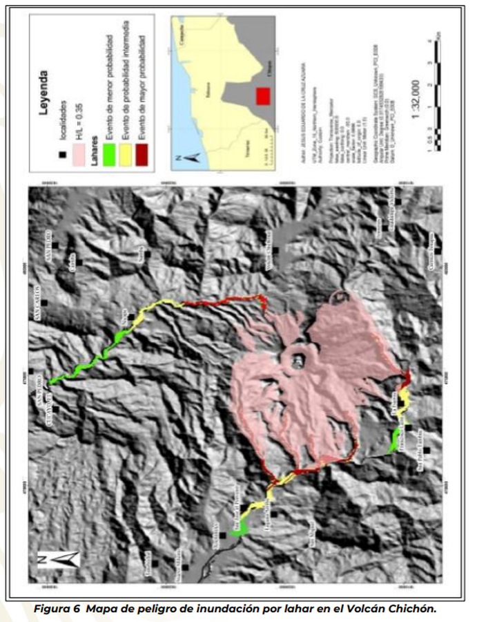
Mapa de peligro de inundación por lahar en el Volcán Chichón
Hazard map of flooding by lahar at Chichón Volcano
El Chichón, Mexico, 2018
Figure 6 in: Subsecretaría de Planeacíon, Informacíon y Protección Civil, Coorinacíon Nacional de Protección Civil, & Centro Nacional de Prevención de Desastres. (2018). Report Of Practical Hazard Maps Of Volcanoes, Ceboruco, Colima, Citlaltépetl, Chichonal And Tacaná. Subdirección de Riesgos Volcánicos. Dirección de Investigación. Ciudad de México.
This map was produced by an official agency, but may not be the most recent, most complete, or main operational map.
For the current operational hazard map, please consult the proper institutional authorities.
Click on image for full-size map. If link seems broken, try the archived version.
Subsecretaría de Planeacíon, Informacíon y Protección Civil, Coorinacíon Nacional de Protección Civil, & Centro Nacional de Prevención de Desastres. (2018). Report Of Practical Hazard Maps Of Volcanoes, Ceboruco, Colima, Citlaltépetl, Chichonal And Tacaná. Subdirección de Riesgos Volcánicos. Dirección de Investigación. Ciudad de México.Map Set
https://www1.cenapred.unam.mx/DIR_INVESTIGACION/2109/FRACCION_XLI/RV/10_Mapas_Practicos_2018.pdf
Other Maps In Set: