
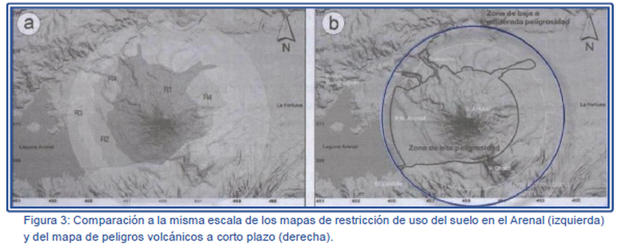
Comparación a la misma escala de los mapas de restricción de uso del suelo en el Arenal (izquierda) y del mapa de peligros volcánicos a corto plazo (derecha).
Comparison at the same scale of the Arenal land use restriction maps (left) and the short-term volcanic hazard map (right).
Arenal, Costa Rica, 2007
Figure 3 in: Soto, G.J. & Sjöbohm, L. (2007). Los Peligros volcánicos del Arenal. En torno a la Prevencion. Revista No. 4, Junio 2007. Comisión Nacional de Prevención de Riesgos y Atención de Emergencias (CNE).
This hazard map is the result of scientific research and was published in academic literature.
It is presented here to serve as an example of the map type or the map-making methodology. It is NOT the official, operational map. For the current operational hazard map, please consult the proper institutional authorities.
Click on thumbnail for full-size map. We do not have copyright permission to display the full-size image. If you are the copyright holder and wish to provide copyright, please contact us at admin@volcanichazardmaps.org. If link seems broken, try the archived version.
Soto, G.J. & Sjöbohm, L. (2007). Entorno a la Prevencion. Revista No. 4, Junio 2007. Comisión Nacional de Prevención de Riesgos y Atención de Emergencias (CNE).Map Set
Other Maps In Set: