
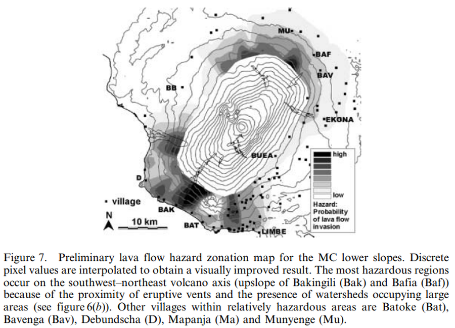
Preliminary lava flow hazard zonation map for the MC lower slopes
Cameroon, Cameroon, 2008
Figure 7 in: Bonne, K., Kervyn, M., Cascone, L., Njome, S., Van Ranst, E., Suh, E., Ayonghe, S., & Ernst, G. (2008). A new approach to assess long‐term lava flow hazard and risk using GIS and low‐cost remote sensing: the case of Mount Cameroon, West Africa. International Journal of Remote Sensing, 29(22), 6539-6564. https://doi.org/10.1080/01431160802167873
This hazard map is the result of scientific research and was published in academic literature.
It is presented here to serve as an example of the map type or the map-making methodology. It is NOT the official, operational map. For the current operational hazard map, please consult the proper institutional authorities.
Click on thumbnail for full-size map. We do not have copyright permission to display the full-size image. If you are the copyright holder and wish to provide copyright, please contact us at admin@volcanichazardmaps.org.
Map Set
Bonne, K., Kervyn, M., Cascone, L., Njome, S., Van Ranst, E., Suh, E., Ayonghe, S., & Ernst, G. (2008). A new approach to assess long‐term lava flow hazard and risk using GIS and low‐cost remote sensing: the case of Mount Cameroon, West Africa. International Journal of Remote Sensing, 29(22), 6539-6564. https://doi.org/10.1080/01431160802167873
https://doi.org/10.1080/01431160802167873
Other Maps In Set: