← Back to Search Results

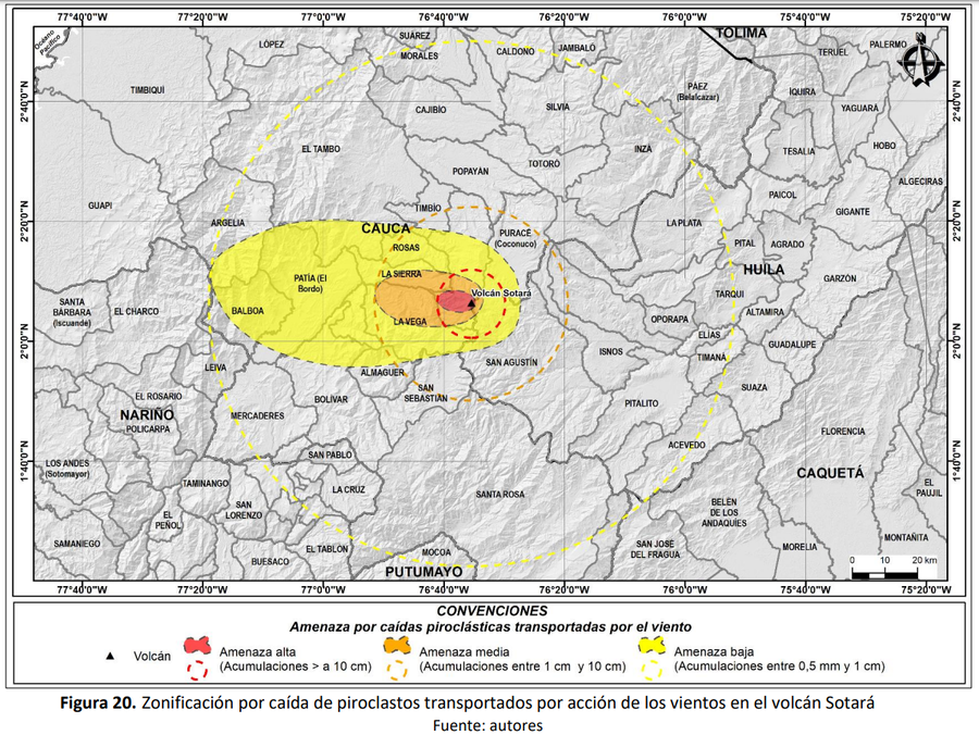
Zonificación por caída de piroclastos transportados por acción de los vientos en el volcán Sotará

Zoning due to the fall of pyroclasts transported by the action of the winds at Sotará volcano

Sotará, Colombia, 2019

Figure 20 in: Pulgarín, B., Zuluaga, I., Galarza, J. Muñoz, C. y Laverde, C. (2019). Memoria del mapa de amenaza volcánica del volcán Sotará. Popayán, Pasto y Bogotá: Servicio Geológico Colombiano.


This map was produced by an official agency, but may not be the most recent, most complete, or main operational map. For the current operational hazard map, please consult the proper institutional authorities.


Click on image for full-size map. If link seems broken, try the archived version.

Map Set

Pulgarín, B., Zuluaga, I., Galarza, J. Muñoz, C. y Laverde, C. (2019). Memoria del mapa de amenaza volcánica del volcán Sotará. Popayán, Pasto y Bogotá: Servicio Geológico Colombiano.
https://www2.sgc.gov.co/sgc/volcanes/VolcanSotara/Paginas/mapa-de-amenaza.aspx#

Other Maps In Set:

Map Data

Map ID3706
Hazard Process(es)Tephra fall
Hazard Zone PresentationSingle hazard: A single hazard process is represented on a main map panel
Temporal ScaleBackground, or long-term, map
Spatial ScaleVolcano and surrounding area
Publication FormatFigure in a hazard assessment or mitigation plan
Zonation Method(s)Probabilistic modeling
Zonation Model(s)Tephra2 (Bonadonna et al. 2005; Bonadonna et al. 2010; Connor et al. 2011); TephraProb (Biass et al. 2016)
Scenario(s) ConsideredAnalog volcano(es); Season or weather; Size, VEI, or intensity
Hazard Zone Label(s)Estimated value or Hazard Impact Metric; Qualitative relative probability (e.g. high-medium-low)
Probability Definition(s)Qualitative relative probability (e.g. high-medium-low)
PurposeMultiple: intended for multiple purposes including general hazard awareness, planning, and crisis management
AudienceMultiple audiences (usually the public, civil authorities, and land-use planners)
Language(s)Spanish
Basemap(s)Hillshade
Basemap overlay(s)Administrative boundaries (e.g. county, park, intl.)
DiemsionalityPlanimetric (2D or map) view
Color SchemeRed to Yellow
Go to Global Volcanism Program page for Sotará →