
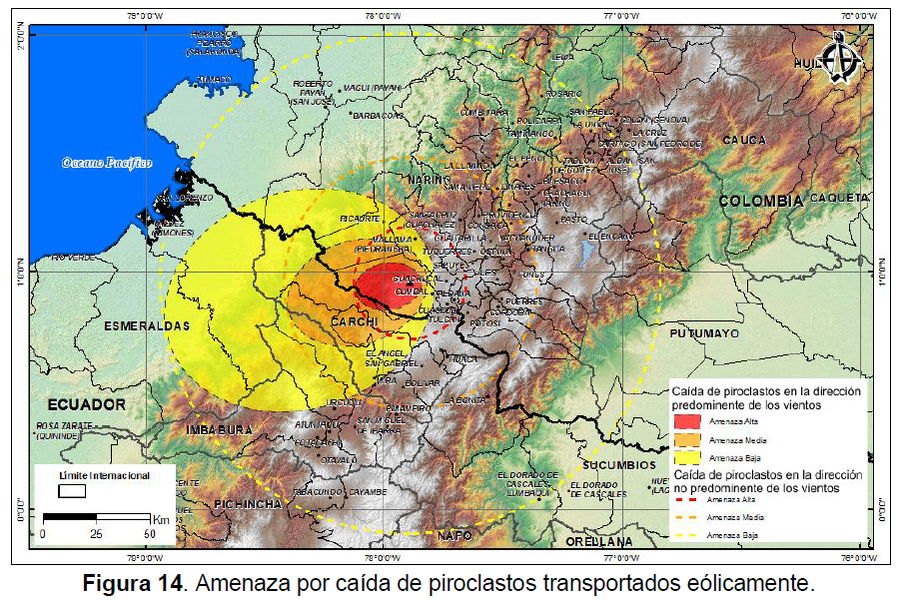
Amenaza por caída de piroclastos transportados eólicamente
Hazard from falling wind-borne pyroclasts
Cumbal, Colombia, 2014
Figure 14 in: Méndez, R., Narváez, P., Muñoz, C. (2014). Mapa de Amenaza Volcánica del Complejo Volcánico Cumbal -- Segunda Versión. Memoria Explicativa. San Juan de Pasto: Servicio Geológico Colombiano.
This map was produced by an official agency, but may not be the most recent, most complete, or main operational map.
For the current operational hazard map, please consult the proper institutional authorities.
Click on image for full-size map. If link seems broken, try the archived version.
Méndez, R., Narváez, P., Muñoz, C. (2014). Mapa de Amenaza Volcánica del Complejo Volcánico Cumbal -- Segunda Versión. Memoria Explicativa. San Juan de Pasto: Servicio Geológico Colombiano.Map Set
https://www2.sgc.gov.co/sgc/volcanes/VolcanCumbal/PublishingImages/Paginas/mapa-de-amenaza/MemoExplMapaAmenCVCumbal2daV2014.pdf
Other Maps In Set: