
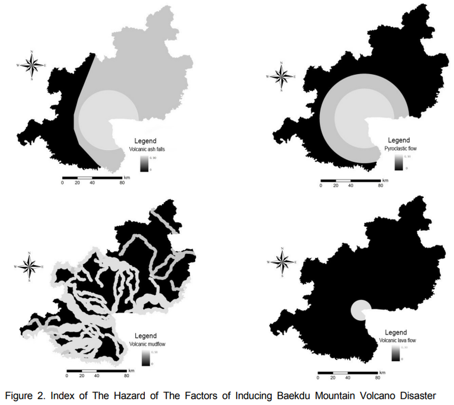
Index of The Hazard of The Factors of Inducing Baekdu Mountain Volcano Disaster
Baekdusan (Changbaishan), China-North Korea, 2020
Figure 2 in: Xiao-Jiao, N., Choi, Y. S., & Ying, N. (2014). A Study on Integrated Assessment of Baekdu Mountain Volcanic Aisaster risk Based on GIS. Journal of Korea Spatial Information Society. Korea Spatial Information Society. https://doi.org/10.12672/ksis.2014.22.4.077
This hazard map is the result of scientific research and was published in academic literature.
It is presented here to serve as an example of the map type or the map-making methodology. It is NOT the official, operational map. For the current operational hazard map, please consult the proper institutional authorities.
Click on image for full-size map. If link seems broken, try the archived version.
Xiao-Jiao, N., Choi, Y. S., & Ying, N. (2014). A Study on Integrated Assessment of Baekdu Mountain Volcanic Aisaster risk Based on GIS. Journal of Korea Spatial Information Society. Korea Spatial Information Society. https://doi.org/10.12672/ksis.2014.22.4.077Map Set
http://dx.doi.org/10.12672/ksis.2014.22.4.077
Other Maps In Set: