← Back to Search Results

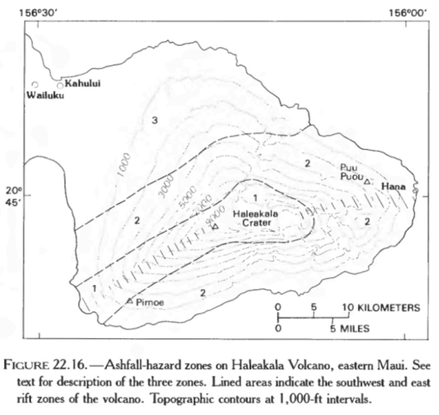
Ashfall-hazard zones on Haleakala Volcano, eastern Maui.

Haleakala, United States, 1987

Figure 22.16 in: Mullineaux, D.R., Peterson, D.W., & Crandell, D.R. (1987). Volcanic hazards in the Hawaiian Islands. In: Decker, R.W., Wright, T.L., & Stauffer, P.H. (Eds.) Volcanism in Hawaii. US Geological Survey Professional Paper 1350, Chapter 22, p. 599-621. https://doi.org/10.3133/pp1350


This map was produced by an official agency, but is NOT the most recent, most complete, or main operational map. For the current operational hazard map, please consult the proper institutional authorities.


Click on image for full-size map. If link seems broken, try the archived version.

Map Set

Mullineaux, D.R., Peterson, D.W., & Crandell, D.R. (1987). Volcanic hazards in the Hawaiian Islands. In: Decker, R.W., Wright, T.L., & Stauffer, P.H. (Eds.) Volcanism in Hawaii. US Geological Survey Professional Paper 1350, Chapter 22, p. 599-621. https://doi.org/10.3133/pp1350
https://doi.org/10.3133/pp1350

Other Maps In Set:

Map Data

Map ID3734
Hazard Process(es)Tephra fall
Hazard Zone PresentationSingle hazard: A single hazard process is represented on a main map panel
Temporal ScaleBackground, or long-term, map
Spatial ScaleVolcano and surrounding area
Publication FormatFigure in a hazard assessment or mitigation plan
Zonation Method(s)Geologic history
Zonation Model(s)
Scenario(s) ConsideredNo scenarios were discernable from the map
Hazard Zone Label(s)Qualitative relative probability (e.g. high-medium-low)
Probability Definition(s)Qualitative relative probability (e.g. high-medium-low)
PurposeMultiple: intended for multiple purposes including general hazard awareness, planning, and crisis management
AudienceMultiple audiences (usually the public, civil authorities, and land-use planners)
Language(s)English
Basemap(s)Contour lines
Basemap overlay(s)
DiemsionalityPlanimetric (2D or map) view
Color SchemeSymbols and/or lines only
Go to Global Volcanism Program page for Haleakala →