← Back to Search Results

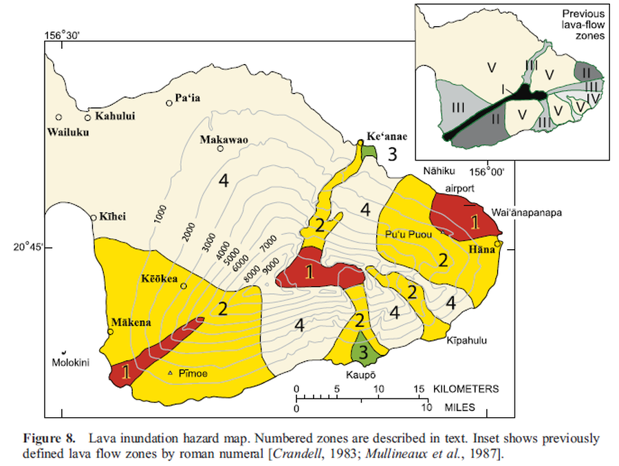
Lava inundation hazard map

Haleakala, United States, 2006

Figure 8 in: Sherrod, D. R., Hagstrum, J. T., McGeehin, J. P., Champion, D. E., & Trusdell, F. A. (2006). Distribution, 14C chronology, and paleomagnetism of latest Pleistocene and Holocene lava flows at Haleakalā volcano, Island of Maui, Hawai ‘i: A revision of lava flow hazard zones. Journal of Geophysical Research: Solid Earth, 111(B5).


This map was produced by an official agency, but may not be the most recent, most complete, or main operational map. For the current operational hazard map, please consult the proper institutional authorities.


Click on image for full-size map.

Map Data

Map ID3736
Hazard Process(es)Lava flows
Hazard Zone PresentationSingle hazard: A single hazard process is represented on a main map panel
Temporal ScaleBackground, or long-term, map
Spatial ScaleVolcano and surrounding area
Publication FormatFigure in a journal article
Zonation Method(s)Geologic history
Zonation Model(s)
Scenario(s) ConsideredNo scenarios were discernable from the map
Hazard Zone Label(s)Qualitative relative probability (e.g. high-medium-low)
Probability Definition(s)Recurrence interval
PurposeScientific interest: Intended for scientific research and general scientific interest; usually published in academic journals
AudienceScientists (usually in scientific publication)
Language(s)English
Basemap(s)Contour lines
Basemap overlay(s)
DiemsionalityPlanimetric (2D or map) view
Color SchemeRed to Green
Go to Global Volcanism Program page for Haleakala →