← Back to Search Results

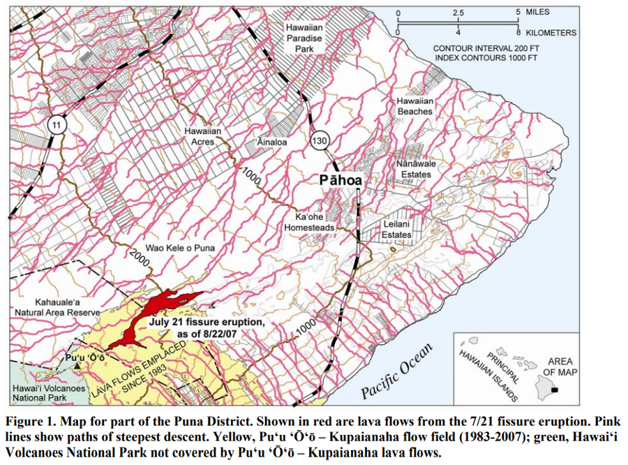
Map for part of the Puna District

Kilauea, United States, 2007

Figure 1 in: Kauahikaua, J. (2007). Lava flow hazard assessment, as of August 2007, for Kīlauea east rift zone eruptions, Hawai‘i Island. U.S. Geological Survey Open-File Report 2007-1264, 9 p.


This map was produced by an official agency, but is NOT the most recent, most complete, or main operational map. For the current operational hazard map, please consult the proper institutional authorities.


Click on image for full-size map. If link seems broken, try the archived version.

Map Data

Map ID3740
Hazard Process(es)Lava flows
Hazard Zone PresentationSingle hazard: A single hazard process is represented on a main map panel
Temporal ScaleVery short-term crisis map (hours to days)
Spatial ScalePart of volcano (flank or drainage)
Publication FormatFigure in a hazard assessment or mitigation plan
Zonation Method(s)Scenario modeling
Zonation Model(s)Lines of Steepest Descent (Kauahikaua et al. 1995; Paleo & Trusdell 2002)
Scenario(s) ConsideredNo scenarios were discernable from the map
Hazard Zone Label(s)Hazard process name
Probability Definition(s)No probability definition was discernable from the map
PurposeMultiple: intended for multiple purposes including general hazard awareness, planning, and crisis management
AudienceMultiple audiences (usually the public, civil authorities, and land-use planners)
Language(s)English
Basemap(s)Contour lines
Basemap overlay(s)Street map
DiemsionalityPlanimetric (2D or map) view
Color SchemeSingle color
Go to Global Volcanism Program page for Kilauea →