
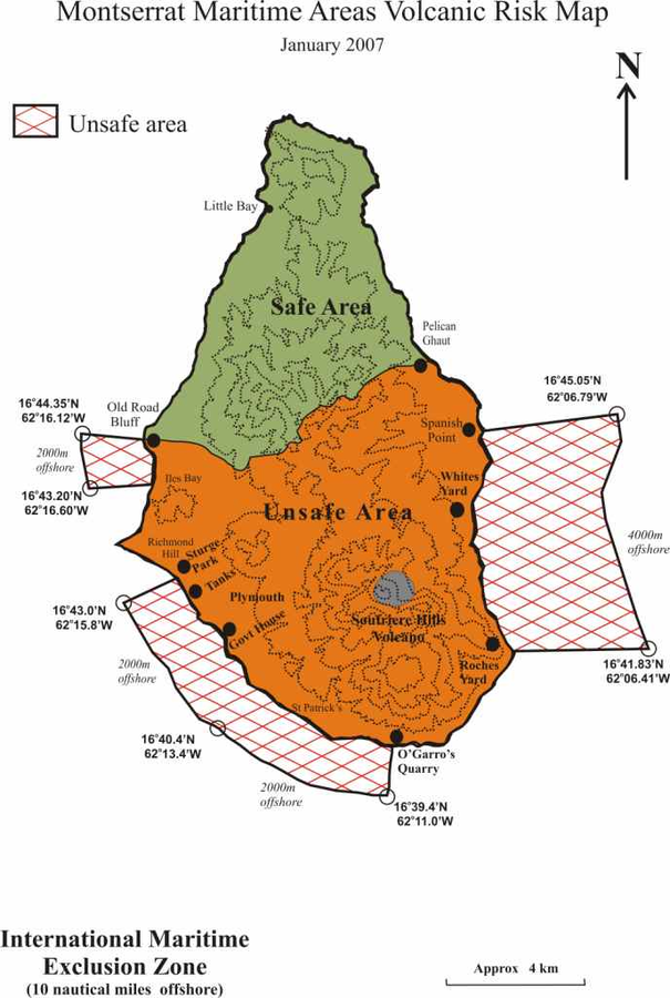
Montserrat Maritime Areas Volcanic Risk Map January 2007
Soufrière Hills, Montserrat [United Kingdom], 2007
Montserrat Volcano Observatory (MVO). (2007). Montserrat Maritime Areas Volcanic Risk Map January 2007.
This map was produced by an official agency, but is NOT the most recent, most complete, or main operational map.
For the current operational hazard map, please consult the proper institutional authorities.
Click on image for full-size map. If link seems broken, try the archived version.