← Back to Search Results

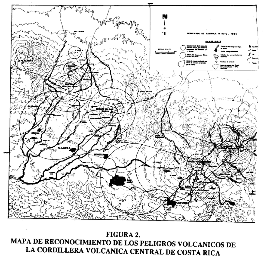
Mapa de Reconocimiento de los Peligros Volcánicos de la Cordillera Volcánica Central de Costa Rica

Reconnaissance Map of the Volcanic Hazards of the Central Volcanic Cordillera of Costa Rica

Cordillera Volcánica Central (regional), Costa Rica, 1992

Figure 2 in: Soto, G.J. & Paniagua, S. (1992). La Cordillera Volcánica Central (Costa Rica): sus peligros potenciales y prevenciones. Revista Geográfica de América Central, (25-26), 291-304.


This hazard map is the result of scientific research and was published in academic literature. It is presented here to serve as an example of the map type or the map-making methodology. It is NOT the official, operational map. For the current operational hazard map, please consult the proper institutional authorities.


Click on image for full-size map. If link seems broken, try the archived version.

Map Data

Map ID3806
Hazard Process(es)Lahars; Lava flows; PDCs; Tephra fall
Hazard Zone PresentationHazard level- and process-focused: Hazards are both combined by hazard level and separated by hazard process type on a main map panel
Temporal ScaleBackground, or long-term, map
Spatial ScaleRegional
Publication FormatFigure in a journal article
Zonation Method(s)Derived/simplified from another map
Zonation Model(s)
Scenario(s) ConsideredSeason or weather; Size, VEI, or intensity; Source location or direction
Hazard Zone Label(s)Estimated value or Hazard Impact Metric; Hazard process name
Probability Definition(s)Qualitative relative probability (e.g. high-medium-low)
PurposeScientific interest: Intended for scientific research and general scientific interest; usually published in academic journals
AudienceScientists (usually in scientific publication)
Language(s)Spanish
Basemap(s)Contour lines
Basemap overlay(s)Street map
DiemsionalityPlanimetric (2D or map) view
Color SchemeSymbols and/or lines only