
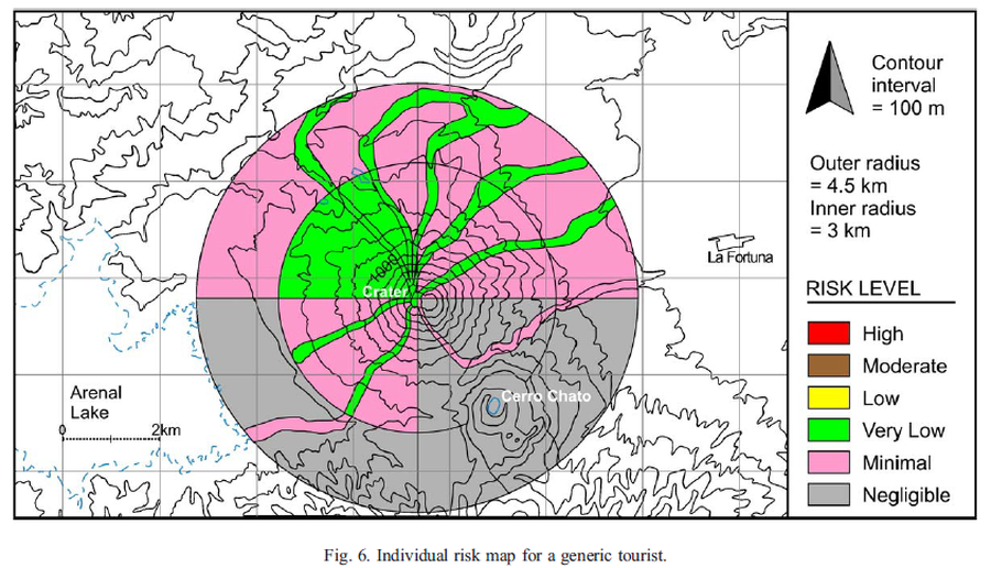
Individual risk map for a generic tourist
Arenal, Costa Rica, 2006
Figure 6 in: Meloy, A. F. (2006). Arenal-type pyroclastic flows: a probabilistic event tree risk analysis. Journal of Volcanology and Geothermal Research, 157(1-3), 121-134. https://doi.org/10.1016/j.jvolgeores.2006.03.048
This hazard map is the result of scientific research and was published in academic literature.
It is presented here to serve as an example of the map type or the map-making methodology. It is NOT the official, operational map. For the current operational hazard map, please consult the proper institutional authorities.
Click on thumbnail for full-size map. We do not have copyright permission to display the full-size image. If you are the copyright holder and wish to provide copyright, please contact us at admin@volcanichazardmaps.org.
Map Set
Meloy, A. F. (2006). Arenal-type pyroclastic flows: a probabilistic event tree risk analysis. Journal of Volcanology and Geothermal Research, 157(1-3), 121-134. https://doi.org/10.1016/j.jvolgeores.2006.03.048
https://doi.org/10.1016/j.jvolgeores.2006.03.048
Other Maps In Set: