← Back to Search Results

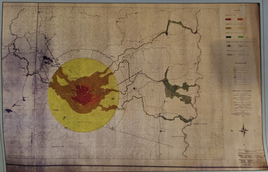
Mapa preliminar de riesgos volcánicos potenciales del Nevado del Ruiz (Octubre 7/85)

Nevado del Ruiz, Colombia, 1985

Cepeda, H., James, M., Murcia, L.A., Parra, E., Salinas, R.Y., & Vergara, H. (1985). Mapa preliminar de riesgos volcánicos potenciales del Nevado del Ruiz. Esc 1:100.000. Memoria Explicativa, 22 p. Instituto Colombiano de Geología y Minería (INGEOMINAS). Octubre 7/85.


This map was produced by an official agency, but is NOT the most recent, most complete, or main operational map. For the current operational hazard map, please consult the proper institutional authorities.


Click on image for full-size map.

Map Data

Map ID3858
Hazard Process(es)
Hazard Zone PresentationHazard process-focused: Most hazard processes are separated by hazard process type on a main map panel
Temporal ScaleBackground, or long-term, map
Spatial ScaleVolcano and surrounding area
Publication FormatMap sheet or poster
Zonation Method(s)
Zonation Model(s)
Scenario(s) ConsideredNo scenarios were discernable from the map
Hazard Zone Label(s)
Probability Definition(s)No probability definition was discernable from the map
PurposeMultiple: intended for multiple purposes including general hazard awareness, planning, and crisis management
AudienceMultiple audiences (usually the public, civil authorities, and land-use planners)
Language(s)Spanish
Basemap(s)Contour lines
Basemap overlay(s)Street map
DiemsionalityPlanimetric (2D or map) view
Color Scheme
Go to Global Volcanism Program page for Nevado del Ruiz →